Shades State Park is a sister park to Turkey Run. They both include a section of Sugar Creek. As my dad says, the difference is that most of the hiking trails at Turkey Run are across the creek, and all of Shades State Park is on the same side of the creek. As a kid, I went on canoe adventures which started east of Shades State Park and traveled through Shades and Turkey Run State Park before ending.
Name: Shades State Park
Location: 10 miles southwest of Crawfordsville, IN
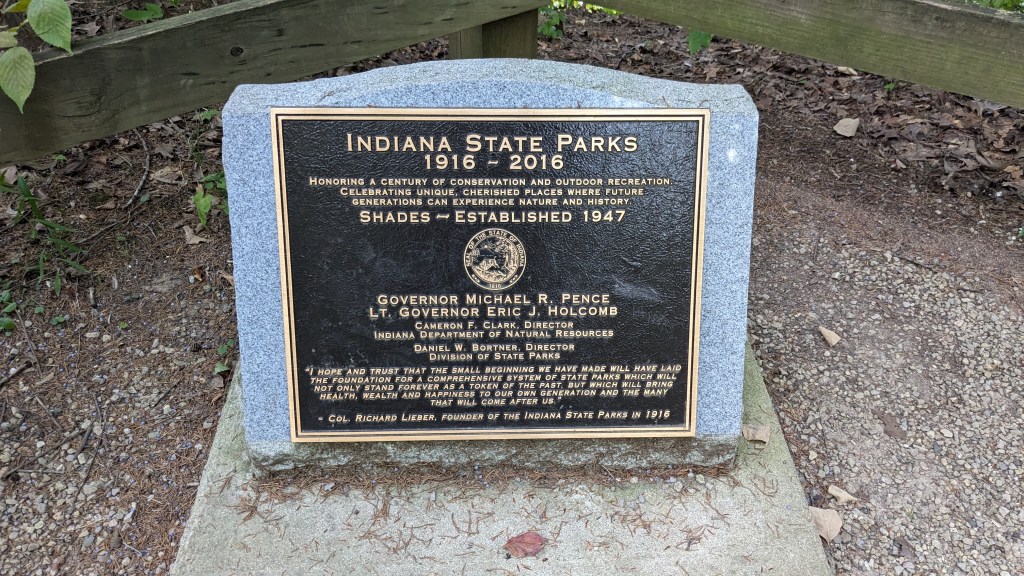
Established: 1947
Size: 3,082 acres
Known For: Several water carved canyons and ravines similar to Turkey Run.


The Day

I have been anticipating this visit for a few weeks. The plan was to stop here on my way back from helping my daughter move into college for the fall semester. This meant that it was late afternoon before I was on my way and nearly 5:30 pm before I made it to the park. Luckily, sunset is still after 8:30, so I had 3 hours to enjoy many of the park’s trails.
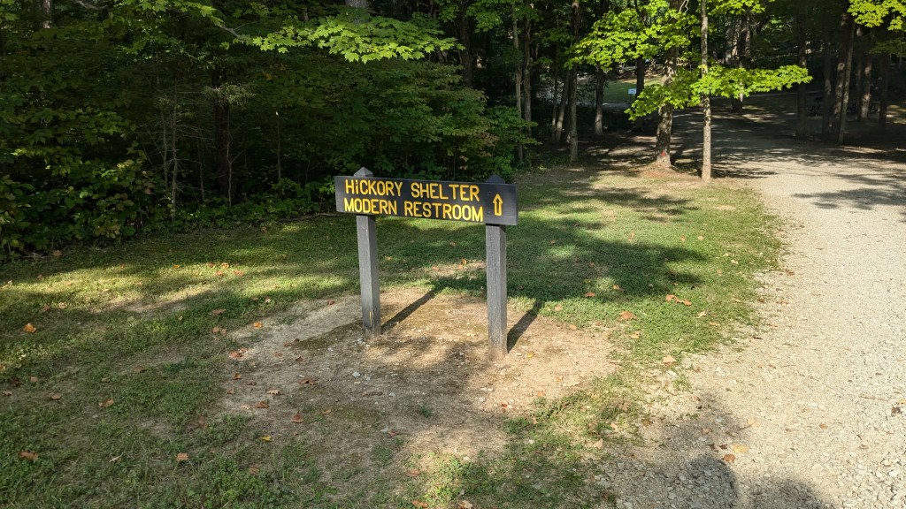
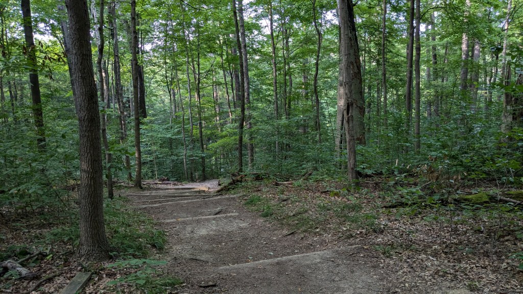
For as long as I had scheduled this visit, I really did very little planning or advanced research. Leaving Illinois, I simply put Shades State Park into my maps and headed off. Once I went through the entrance gate and got a map, I soon realized that most of the trails all connected back to one junction point at the Hickory Picnic Shelter. There is a large parking lot and a modern bathroom with flush toilets. From this one location, you can easily reach trails 1-8.
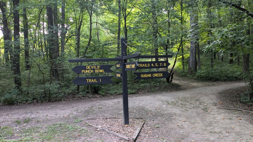
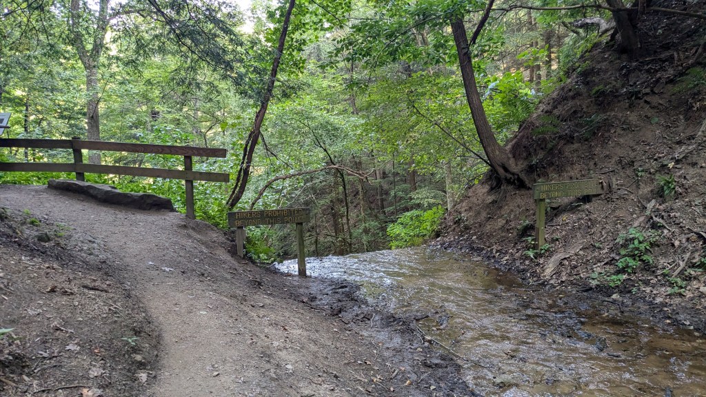
Walking from the parking lot back to the bathroom, you come across a large sign leading you to trails 1, 4,5,7, and 8. Getting to Trail 2 is not obvious, because you have to take Trail 1 to Trail 6 and then Trail 6 to Trail 2. The other option is to drive your car around to the Lover’s Leap parking lot. Having not planned, I just read the signs: Trails 4-8 to the left and Trail 1 and Devil’s Punch Bowl to the right. I knew if they labeled the Devil’s Punchbowl, I should be sure to see it, so I followed the sign left to Trail 1
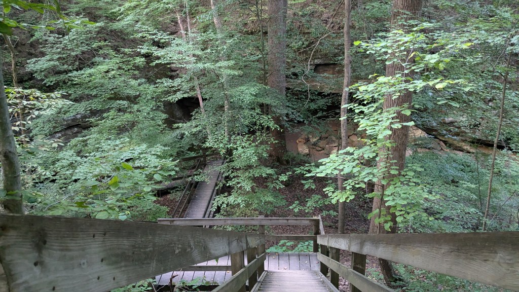
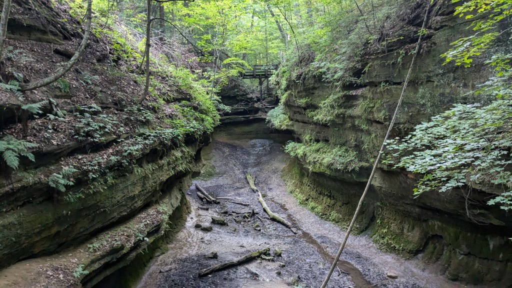
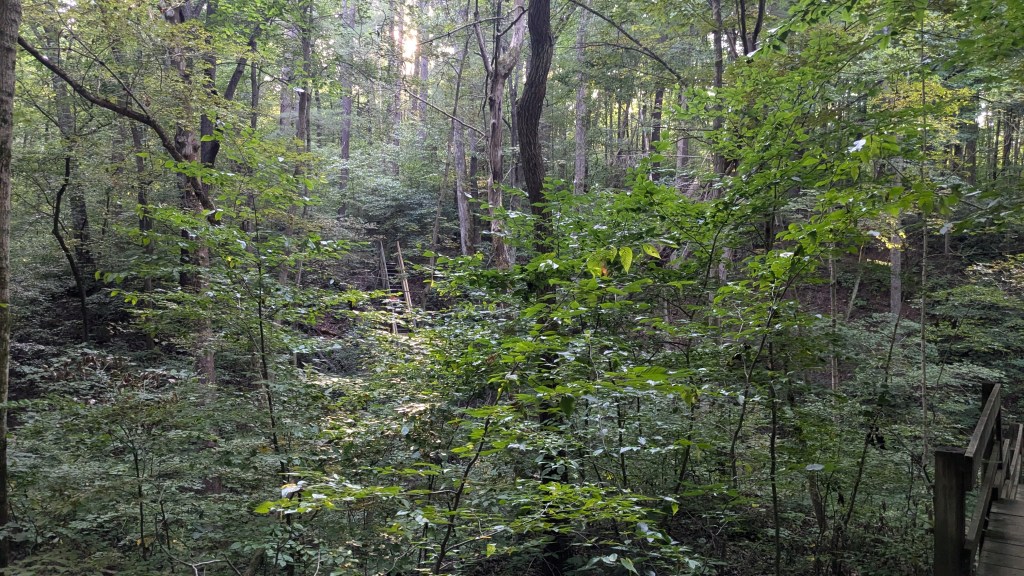
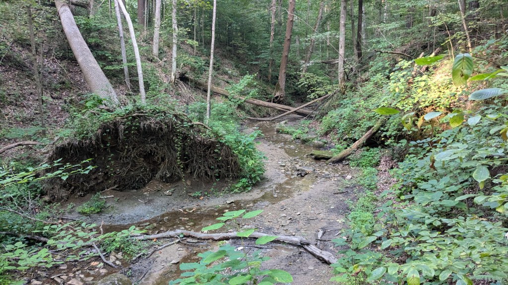
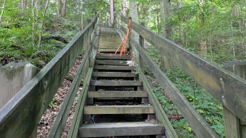
Like Turkey Run SP, most of the trails lead from this high point, which is where the road and parking lot are, down to Sugar Creek, which is the low point. Some of the trails follow the canyon floor and others follow a ridge above the canyon and then use stairs to get down to the creek. All of the trails I hiked did one of these two, so I spent the evening hiking up and down several different canyons and ravines. It sounds like a lot of work, but I actually really enjoy this kind of hiking.
The signage at this park is wonderful. There are many signs along each trail. Even Trail 1 which is really a loop and then a gravel road through the middle is pretty well labeled. I followed the signs which led me in a counter-clockwise direction. I would HIGHLY recommend that you hike it in the other direction. My trek down into the Devil’s Punchbowl came from a series of stairs with some flat sections in between.

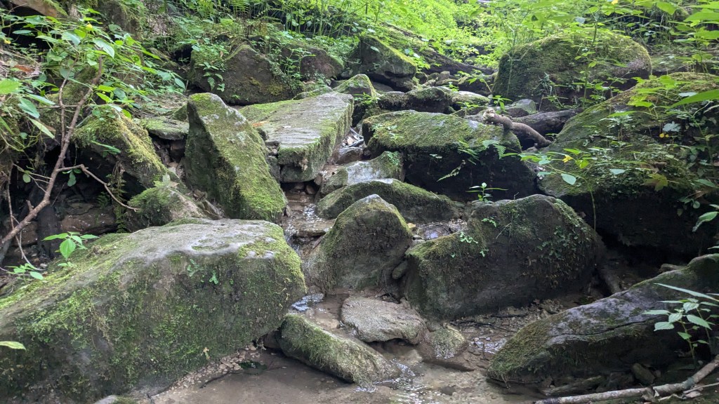
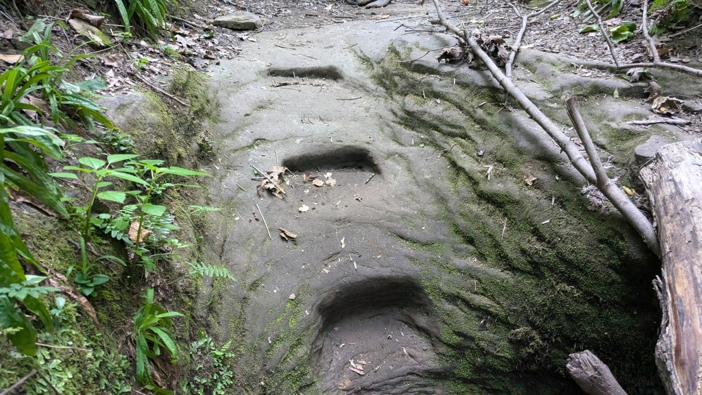
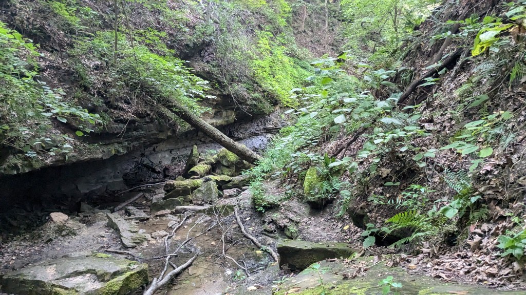
The Punchbowl is also at the highest part of the canyon. It was huge, and at first a little disorienting. It looks like there were three different ways to go, but a little walking around showed that 2 of them were actually high walls. At first, I was confused as to why there was no sign, but then I realized there was only one way to go. From the Punchbowl downstream is the largest canyon in the park in terms of depth and width. I followed the canyon downward until I came upon stairs which bypassed a 10’ waterfall. There wasn’t much water. but it tricklied over the many. many layers of rock.

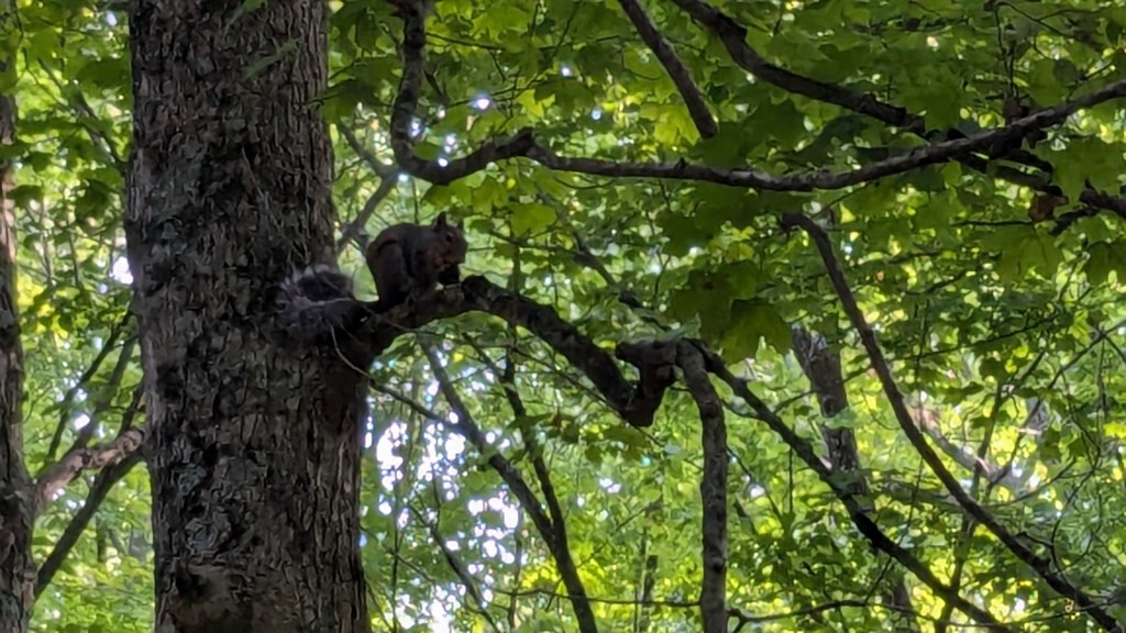
While hiking along the Canyon. a large bird flew silently right over my head and landed on a branch high in a tree ahead of me. My phone is not super great, but I was able to get a couple of photos of him while he perched on a branch and watched me closely. I’m sure he was looking for a nice squirrel or chipmunk for dinner. There were plenty of squirrels, for sure.

At the very bottom of the canyon I was walking in was a huge drop off down to Sugar Creek basin. Not being able to go any farther, the only option were the stairs back to the top of the ridge. These stairs are why I realized I hiked this loop the wrong way. In one long stretch were stairs from the very bottom of the canyon up to a point on the ridge above, which was even higher than my starting point. Had I hiked Trail 1in the opposite direction I would have come down these stairs and then had only a few shorter staircases to climb back up at the other end.

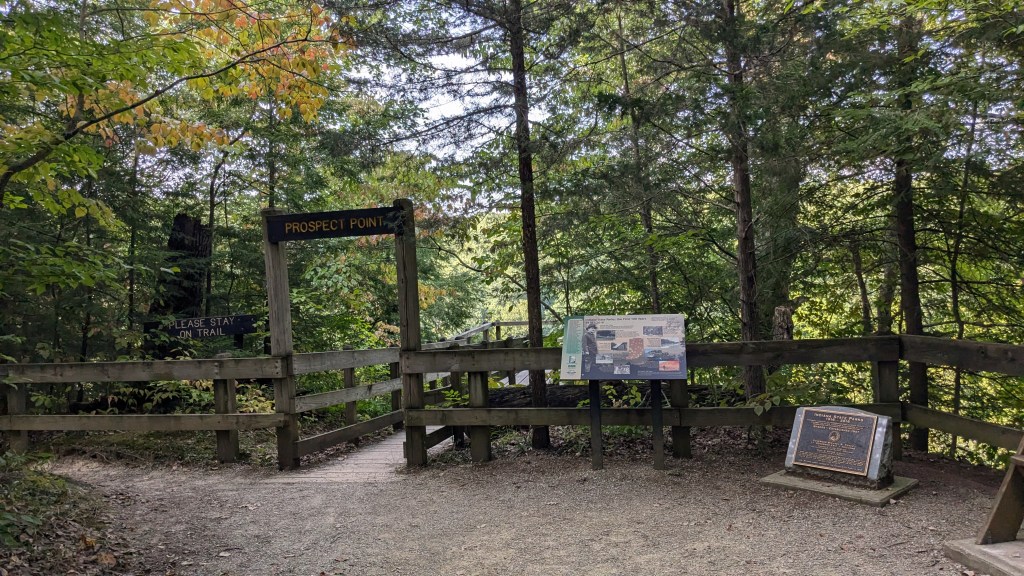
To hike Trail 1 in reverse, you have to look at the map closely and realize that Prospect Point is part of the Trail 1 loop. With this knowledge, the sign at the beginning which points to Prospect Point will guide you in the direction of Trail 1 as well. Despite the great number of stairs, I made it in my counter-clockwise route and took a moment to stop and enjoy the view at Prospect Point before returning to the Hickory Shelter House.
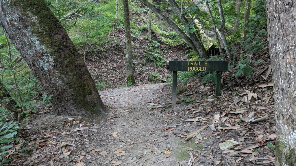
From here, I took a right to head over to trails 4, 5, 7 and 8. The first trail I came to was actually Trail 5. I turned and headed down the trail. This section of Trail 5 was the ridge version. What the signs called “Moderate.” The trail involved a couple of sets of stairs, but otherwise was pretty flat with just a small, but steady, downhill trend. When I got to Sugar Creek, I expected to turn left and take the other half of Trail 5 back up. However, Trail 5 turned right. Wait, what? I looked at the map and realized that the other half of Trail 5 actually ended in the middle of the Hickory Shelter area. It was not on the sign at the main junction at the Hickory Shelter.
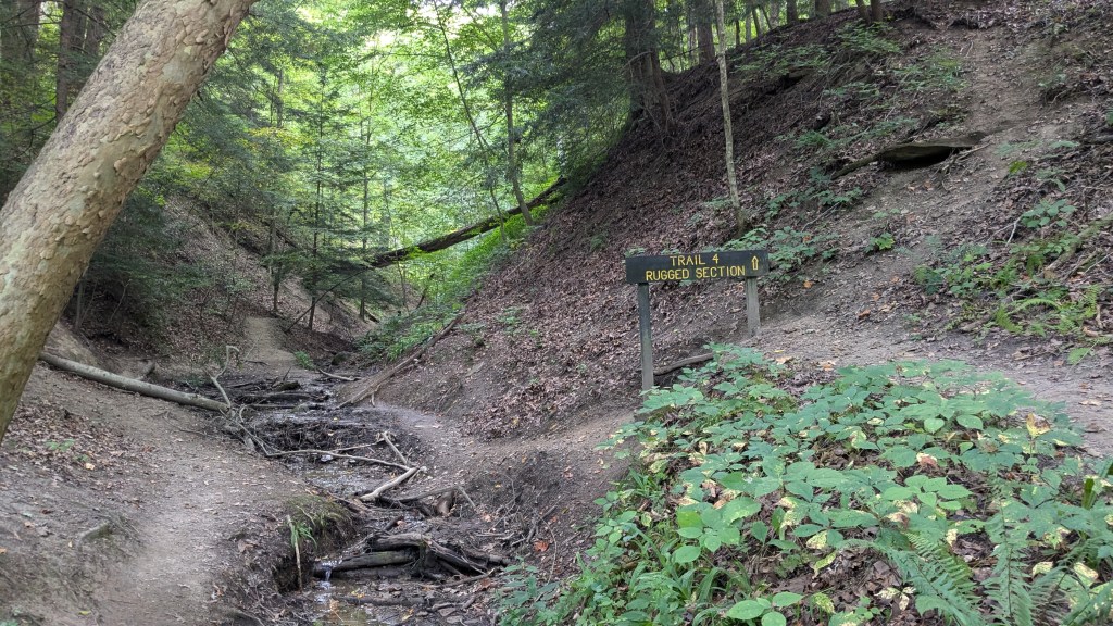
Well, I decided to turn left anyway and go over to Trail 4. It was here on clearly labeled signs that Trail 4 up at the bottom of the canyon was marked “rugged” and the half of Trail 4 that climbed up to the ridge was marked “moderate.” Rugged it is then. The trail was not hard to follow for the most part.

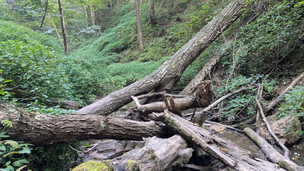
There were a few places where “use trails” (that people created during high water) would lead me up and around things that I didn’t need to avoid. Sometimes, however, the use trails would lead around a fallen tree. There seemed to be little effort to keep the trails clear. There were many places where I had to climb up onto and around large trees that had fallen into the canyon.

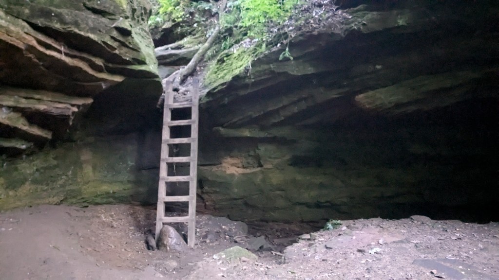
Eventually Trail 4 led me all the way up to where the canyon basically ended. In a few places, there were stairs, and in a couple of places, there were ladders that helped get me up to the next level of the canyon. I wouldn’t recommend any of these trails during a hard rain. LOL. There are lots of places where the water had carved out the rock in beautiful ways.
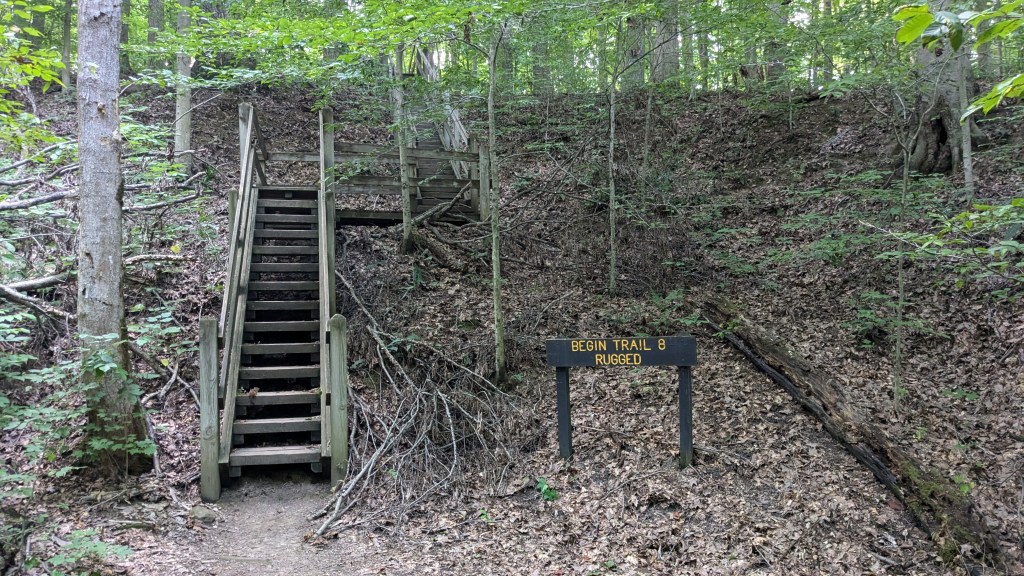
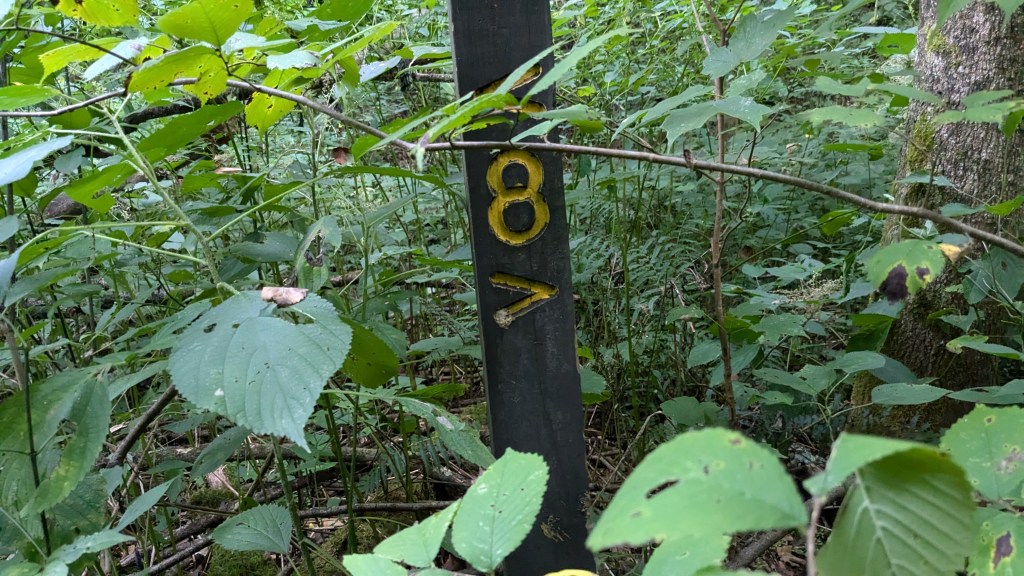
Trails 7 and 8 form a figure 8 of sorts. While Trails 4, 5, and 7 have a Moderate and a Rugged option, trail 8 only has a rugged option. I decided to hike down the rugged Trail 8 and then hike up the rugged half of Trail 7. Here again, I should have done that the other way. Hiking down Trail 8 was the closest to cross country hiking I have done in a while. The beginning of 8 is misleading. This section is also the trail to the campground, but once they split, you are on your own.
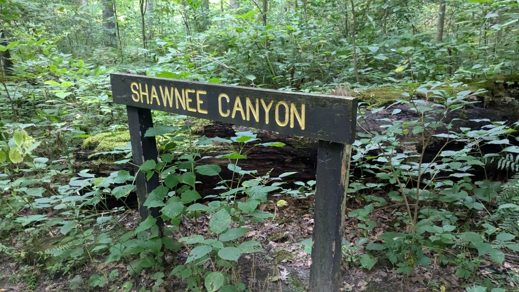
There were several things that made hiking down Trail 8 difficult. The first was the large number of trees that had fallen across the canyon. I was sure I was going in the right direction, downwards, but had to wonder because it did not look like a trail at all, just rocks and trees to climb over. The second thing that made this harder was that looking down over each level change was hard to determine how high it was. Of course, it was only a difference of 1 foot or 4 feet, but if I jumped it made a difference which it was. Had I hiked up Shawnee Canyon, these differences in heights would have been obvious.
What made all of this even more difficult was that the sunlight was starting to disappear. The sun had not set, but it was only hitting the tops of the trees high above my head. The canyon where I was walking was in shadow. My camera photos don’t do this justice. The camera did too good of a job at making every shot bright and beautiful.
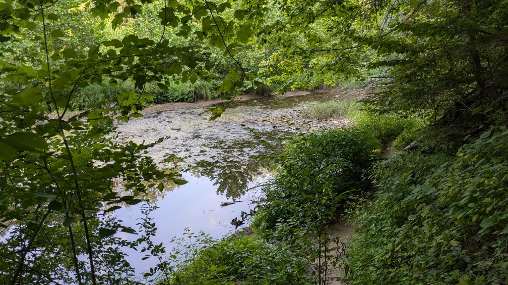
Finally, I got to the bottom of the canyon and came once again to Sugar Creek. Looking up the stairs to the moderate section of Trail 7 made the rugged section look better. They had broken stairs and orange tape. Despite the woods getting darker, my phone said I still had an hour of sunlight, so I headed up the Rugged section of Trail 7.
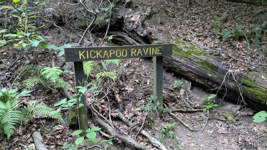
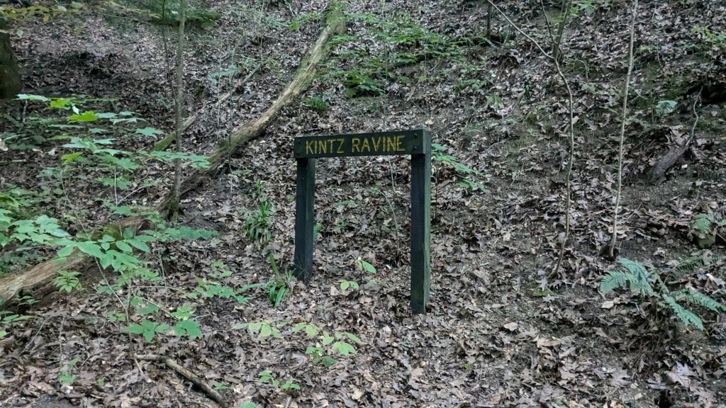
Hiking up Kickapoo Ravine on Trail 7 was similar to the rugged section of Trail 4. It was easier than Trail 8, but still had plenty of trees to climb around and paths to figure out through the dense brush. Before I reached the top of the ravine, a set of stairs led out and back to the main trail. At this point, I had some decisions to make. It was still 30 minutes to sunset. I decided to hike down the Moderate section of 4 and then hike up the Rugged section of Trail 5 which I had missed earlier. The Moderate section of 4 was a breeze to hike. It was wide and gravel covered all the way to Sugar Creek. This is the best way for someone with moderate mobility to make it down to Sugar Creek.
I passed the rugged section of 4 and the moderate section of 5 I had already hiked. I easily found the rugged section of Trail 5 which would be my last for the evening. This was the smallest of the ravines I hiked all day, but that meant that there wasn’t much leeway around obstacles. A set of stairs about halfway up took me around a small waterfall that was still running. I stopped and took a video to capture the unique sound it was making. Finally, I climbed my last ladder of the day in a very rocky and water-carved area of the ravine.
Soon after I climbed the ladder, the ravine became very small and eventually it disappeared altogether. The trail then ended just behind the modern bathroom at Hickory Shelter. I couldn’t believe that I hadn’t seen this trail the two other times I passed by the Hickory Shelter. It was now quite dark, but not so much I would need a flashlight. The sun had set though and only the orange sky to the west was lighting the forest.
I really like hiking up the canyon floors where I have to figure out my path and which rocks to climb or jump across. Because of that, I think I have to list this park as one of my favorite State Parks so far, 2nd only perhaps to Turkey Run. I normally take about 30 to 40 pictures at each park. In the 3 hours I was here, I took over 200. Every turn of each canyon was a new picture perfect scene. All of the unique rock formations and unique curves of each canyon and ravine was worth a photo.
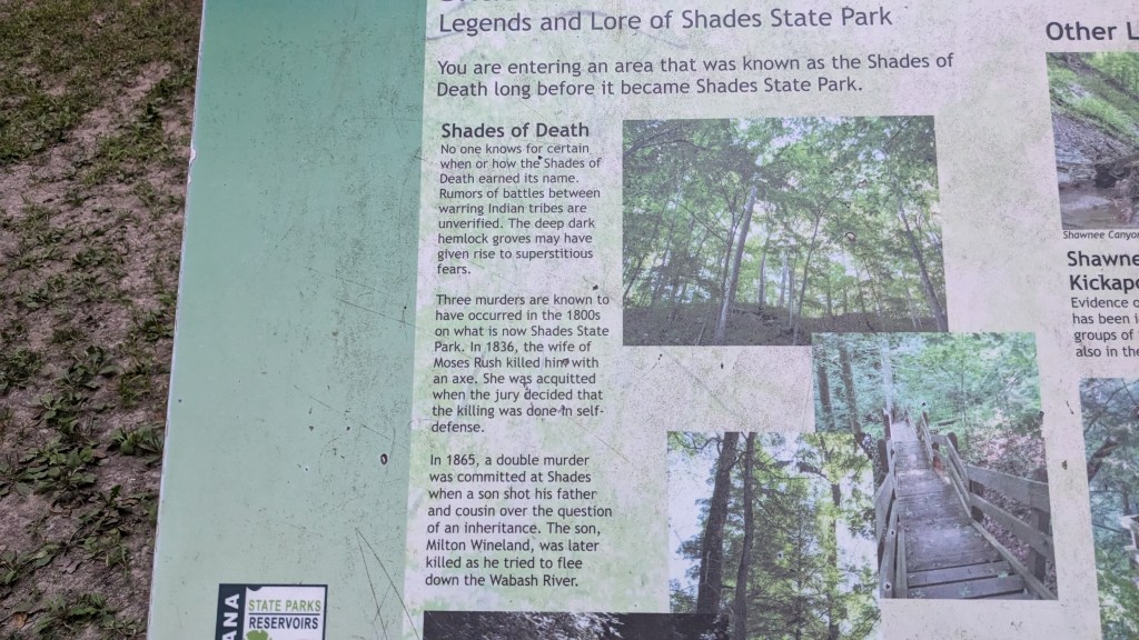
In the dark shadows of the forest, I stopped on my way out to look at a descriptive sign that was labeled “Shades of Death: The legend and lore of Shades State Park.” It was appropriate to read this as the shadows of night were falling around me. One could easily understand why it might have had that name. Despite the name, I really look forward to coming back to this park sometime to continue exploring its beautiful scenery.