Of all the State Parks I remember from when I was a kid, Turkey Run was my favorite. The canyons and unique trails are memories I still hold dear from my childhood. I have memories, too, of many canoe trips down Sugar Creek, sometimes floating under the bridges right through the middle of the park. When my travel this month meant I would be going by the park and have time to stop, I was not going to miss this opportunity to return.
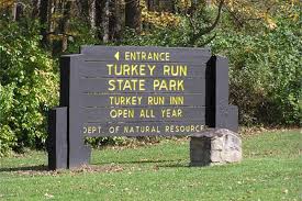
Name: Turkey Run State Park
Location: 2 Miles North of Marshall, IN
Established: 1916
Size: 2,382 acres
Known For: Horseback riding, canoeing, and many moderate to rugged trails that climb up and down the many hollows and small canyons leading to and from Sugar Creek which divides the park in half.


The Day
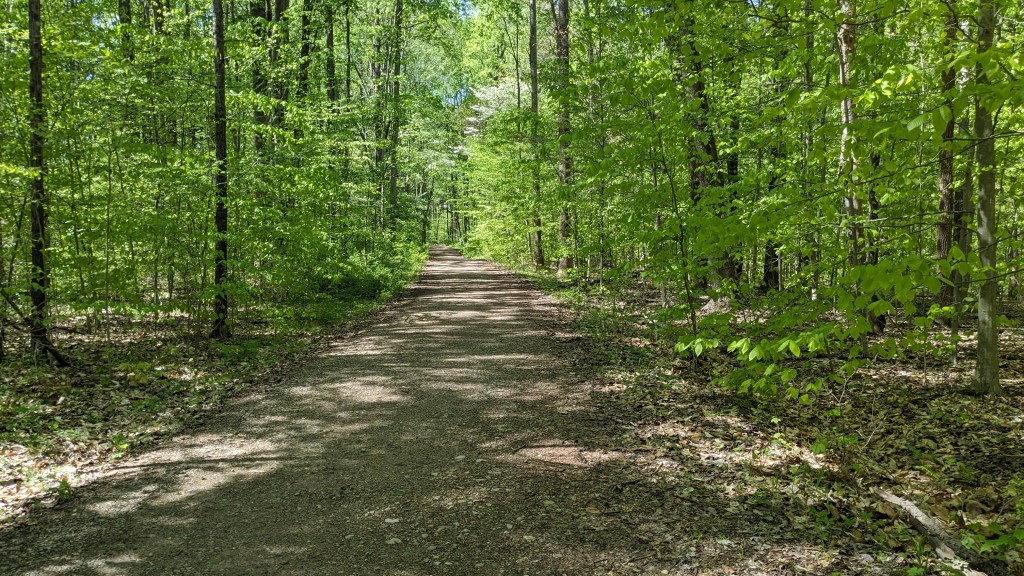
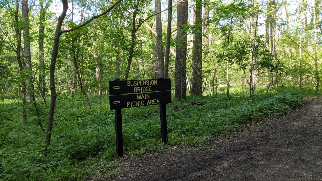
I arrived at Turkey Run about 1pm. Luckily, I stopped at a truck stop to pick up lunch on the way. Driving into the park and getting a map, the first thing I realized was how small the park is, at least road wise. The south side of Sugar Creek is the developed side of the park. There are basically three roads and where they lead to are points no farther than a mile apart. A lot of the 2,000 plus acres are on the north side of Sugar Creek which is only accessible by hiking.
After stopping in the Inn’s parking lot, I looked at the map and decided to drive to the other end of the park…like I said, that was only a mile away at most. The journey I created made more sense starting there. I drove around to the Neuby Gulch shelter house. The map had most of the named landmarks and special geological sites marked on it, so I designed my journey to pass as many as possible with as little duplication as possible.
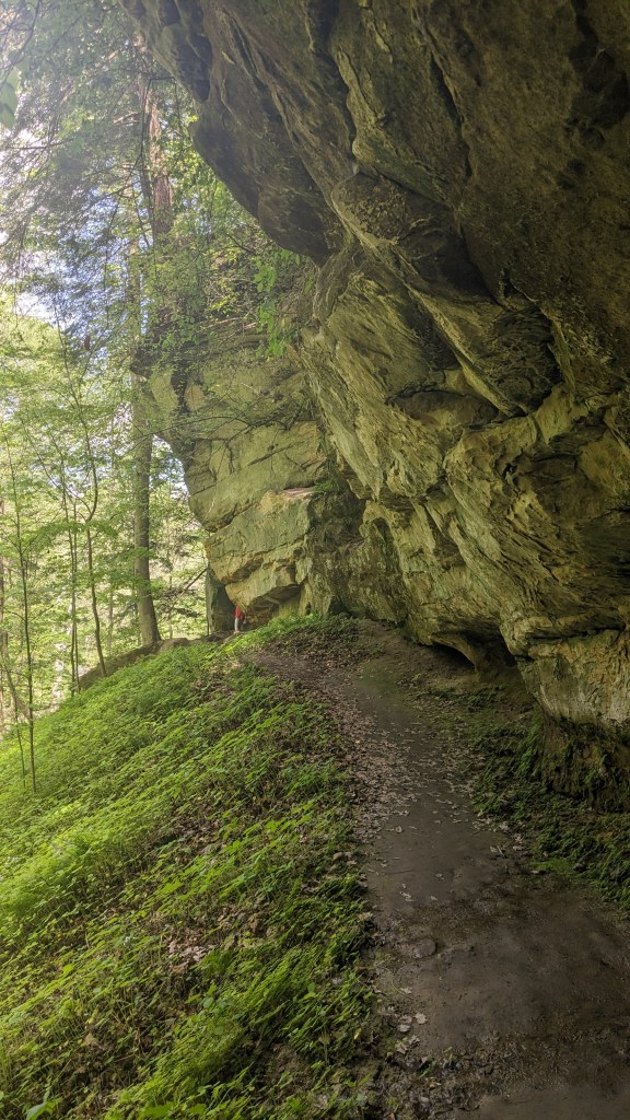
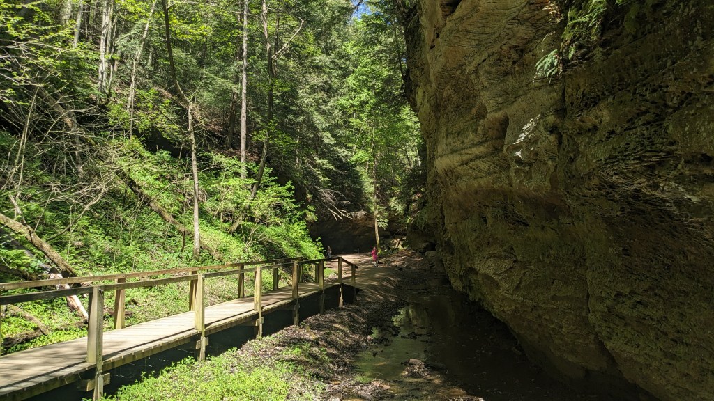
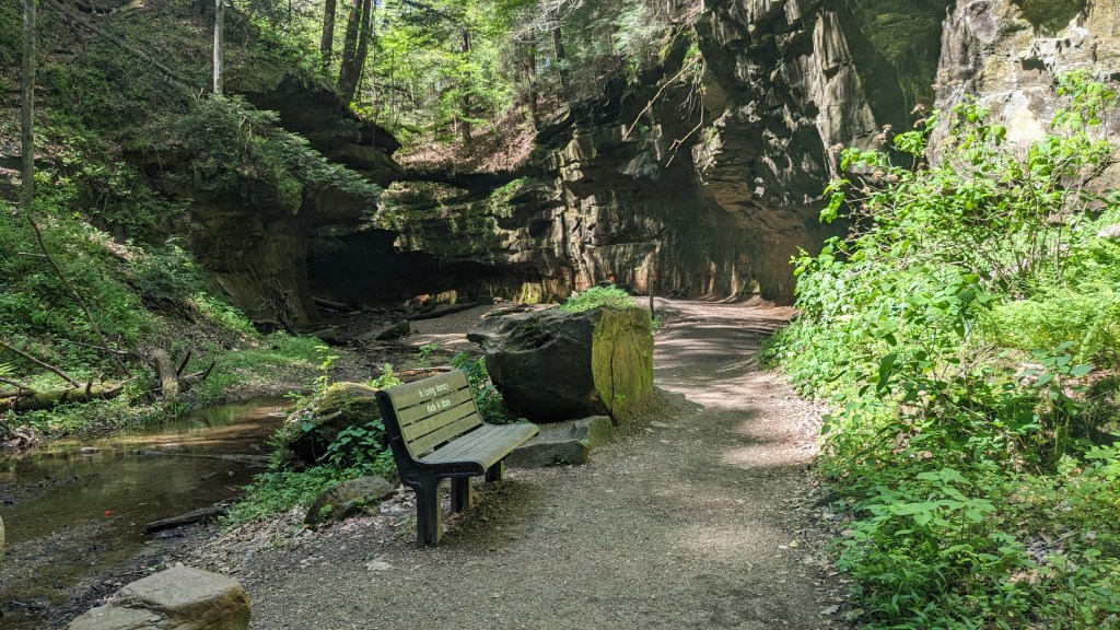
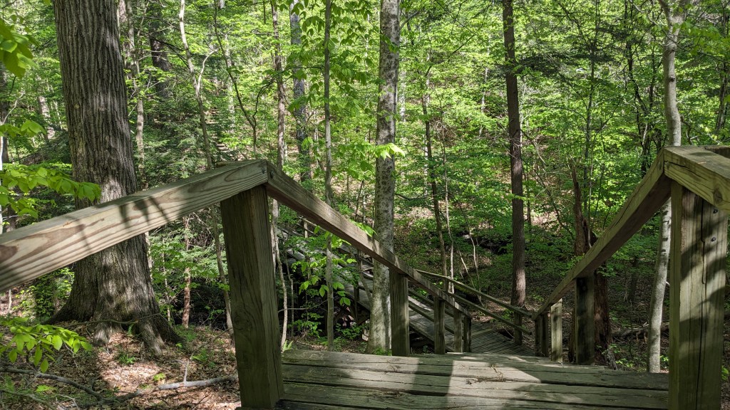
There are two bridges across the river, one in the center and one at the far east end of the park. By driving more toward the east side, it meant I could use the east bridge to cross over and then the main central bridge to return. After parking, it was easy to find the trail as it was both large and labeled with a sign for Trails 1 and 2. The trail, which was more like a fire road, led down to the river where Trail 1 intersected with another connector trail leading to Trail 2.. Here again the trails were labeled enough for me to easily tell which was which. The sign pointing to Trail 2 led to the first labeled landmark “Box Canyon.” The way the trails often squeeze between the different rock formations is a big part of the fun to see and traverse.
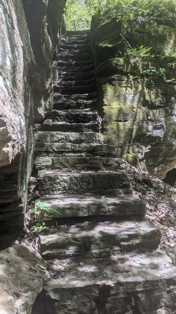
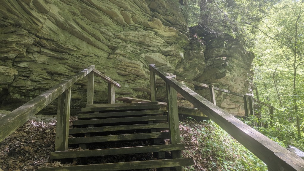
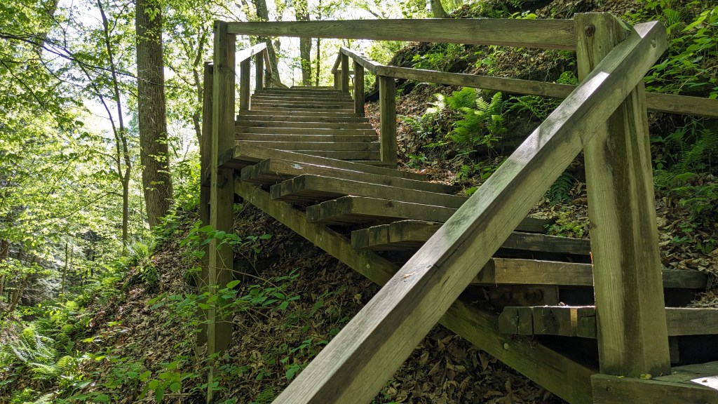
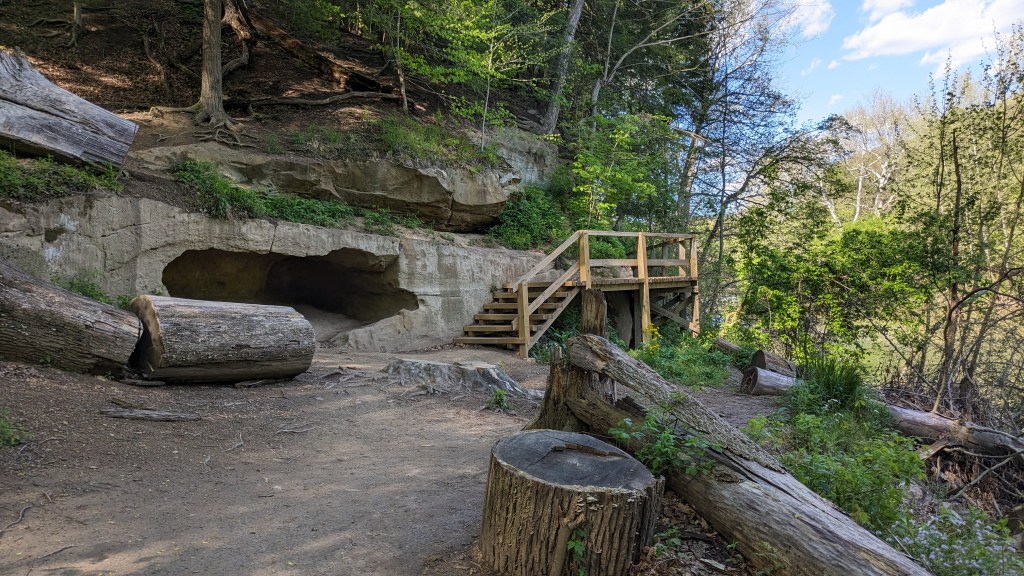
Box Canyon is a simple formation where the trail leaves the ravine and climbs up between two large rock formations. The steps on the trail seemed to be cut directly out of the rock. Once I got to the top of this stone staircase, the trail became a little harder to follow. It split at the top which was on the map. This is where the loop part of Trail 2 starts and ends. However, after taking the left trail I soon came to a second junction. The path in front of me and the right turn were labeled “2” as if it was the split I was looking for, rather than the unlabeled one at the top of the steps. A trail to the left which was unlabeled also looked like it used to have a fence blocking it. The posts were still there, but no board across them anymore. The trail ahead had branches across it in the universal sign of “don’t go this way.”
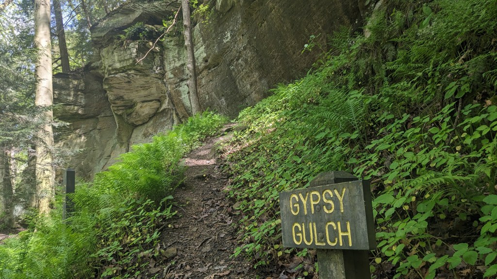
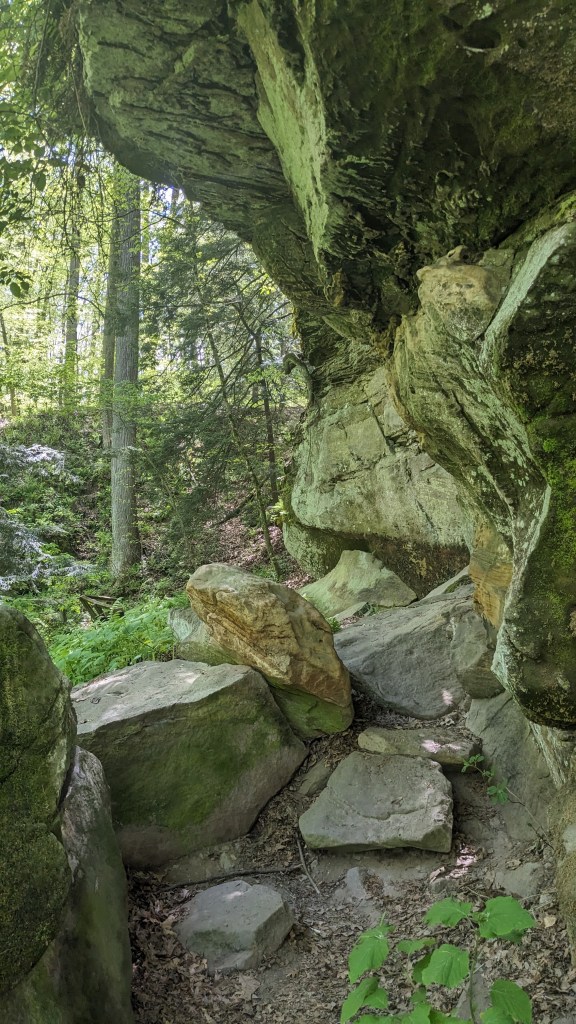
The branches on the trail in front of me were small and looked like they might have just accidentally landed there, so I decided to go straight and see where it led. I soon discovered I was on the right path. The trail clinged to the side of the steep hill high above the creek. There were plenty of places that needed stairs and walkways. I soon came to Gypsy Gulch. This is large carved out section of the hill where it bends. One of the things I noticed is that every landmark on the map has a sign at the actual location. This made it easy to know I was in the right place.
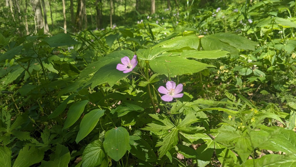
I didn’t pay attention to the map after this and didn’t realize how far I had gone. Where I should have turned left, instead I turned right. When the trail came to a road crossing, I realized my mistake and turned around. I suppose the trail signage could have been better at the junction, but if I had paid attention to the map, I would have known where I was. I found a lot of pretty flowers along this way, so that made the mistake worth it. I was also able to help some other hikers find their way, now that I had figured out where I was.
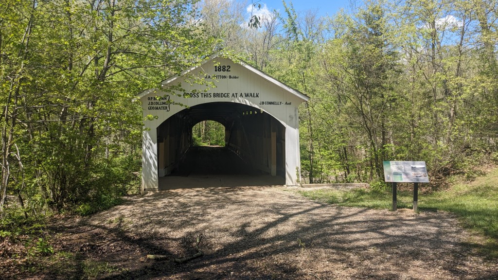
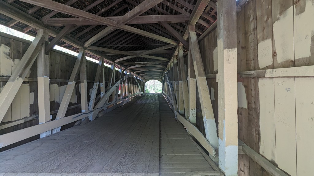
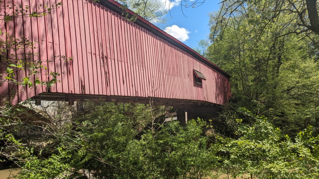
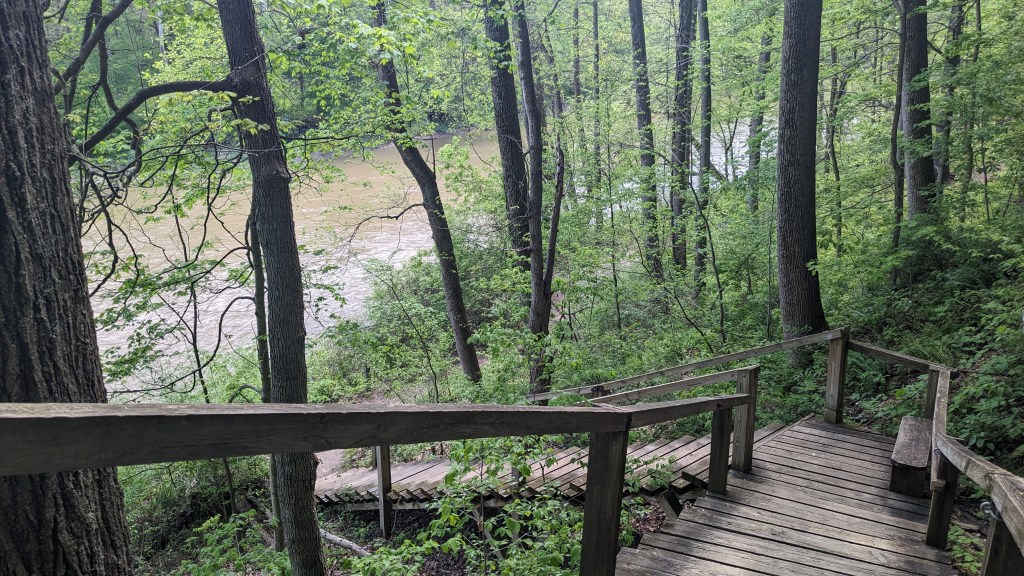
Taking the correct path led me to the East crossing of Sugar Creek. This crossing is the original covered bridge for the road which now crosses a new modern bridge a few dozen feet farther East. The bridge is in relatively good condition and walking across it was a fun walk back in time. You can still see how the original road led across the bridge. On the other side was Trail 4. I took the left Trail 4 back along the water’s edge now on the north side of the creek. I could have taken the longer trail out into the woods, but I really wanted to see the rest of the park and the many more interesting trails.
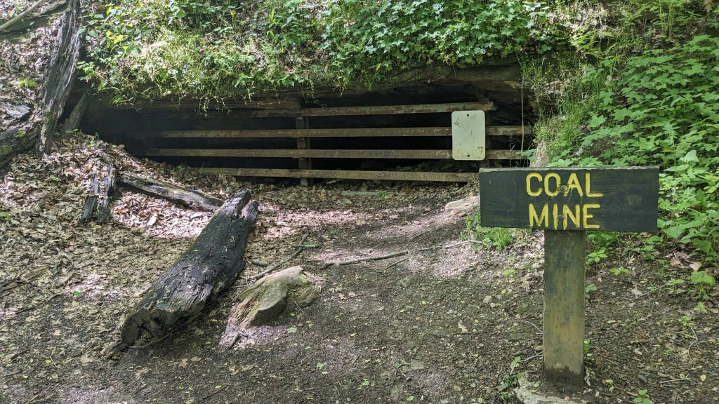
My next stop was labeled “Coal Mine” on the map. Indeed on the side of a hill was an opening with a sign in front of it. There were boards across its opening, but the opening was no higher than 3 feet high. I would not have envied anyone who had to go into it to work. There were also several signs nearby which explained how coal formed there, and the mining process. This was not far from the central bridge and the trails here all had people hiking them, even though it was a Tuesday in April.
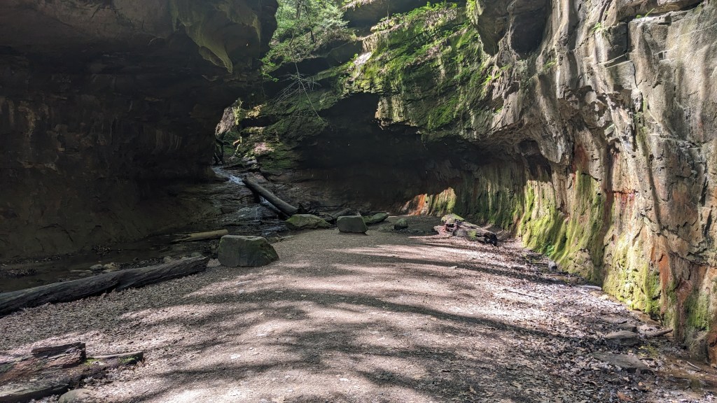
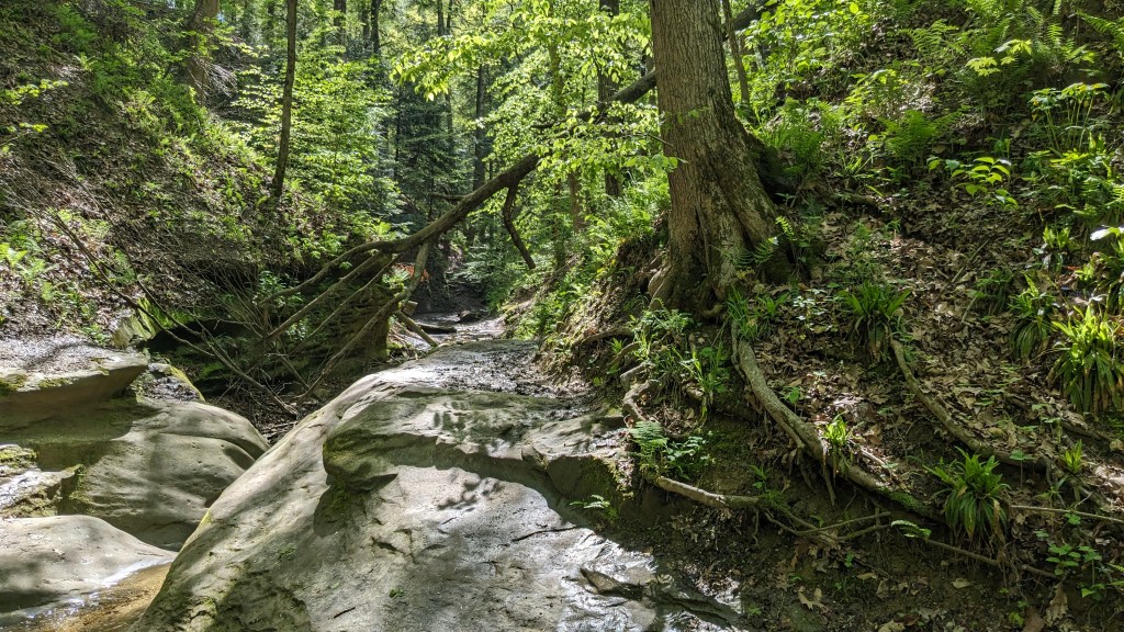
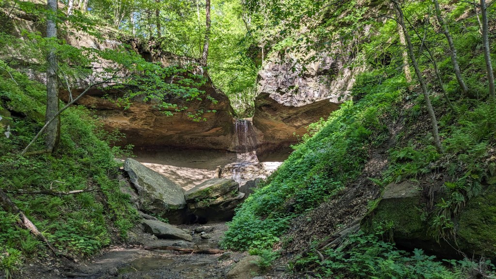
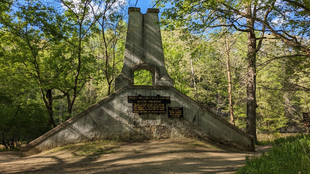
My next adventure was Trail 3 and Rocky Hollow. The Hollow is a narrow canyon about 30 feet wide with rock walls at least 30’ high on either side. They have been carved by thousands of years of water and the curves etched into each side of the hollow make it an amazing place to walk through and experience. It is the iconic shot of Turkey Run seen in many of its advertisements. The hollow is not straight either, it winds as it goes meaning that you only see a hundred feet or so at a time. There is plenty of room to walk beside the small stream running down the center.
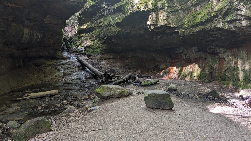
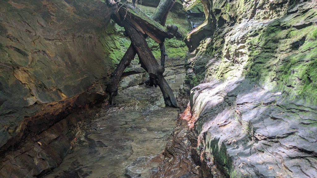
The hollow ends in a waterfall which was about 10 feet tall. The question is “where does the trail go?” Then you realize that up the waterfall is the answer. The waterfall was in layers which allowed just enough ledges to climb it. It led to a long narrow crevice through the rocks only about 5 feet wide. The stream which filled the bottom was about 6 to 8 inches deep. Finding my way up the waterfall, and along this narrow way, without getting my feet wet took some time and good grip on my shoes. Once I was up the waterfall itself, I made my way along one side moving from ledge to ledge. After a short distance, I just happened to notice some small steps cut into the rock on the left side. A thin layer of water was streaming down them from a side water source, but I was able to climb up them to a level about 6 feet up the left side. More obvious steps about a foot wide and a foot deep were cut into the rock and led me the rest of the way up and out of this tiny canyon.
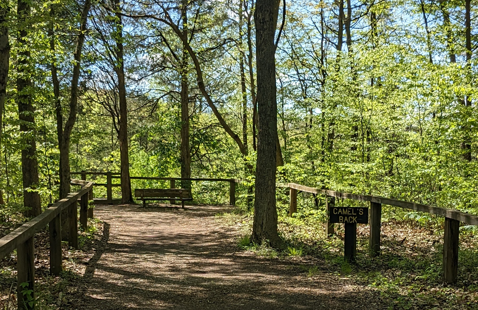
The first hikers I passed going the other way simply took off their socks and just walked straight down the water. The next couple asked how hard it was, and I tried to be accurate adding only that I managed to traverse it without getting wet. Of course, I thought a moment later that climbing up was probably far easier than the climbing down that they would have to do. After this adventure, I came to Trail 10 and climbed out of the ravine and up onto a flat dry trail that led out to the next labeled spot, “Camel’s Back” Having been to other parks, I have come to realize that vistas are fast becoming non-vistas. I wonder if the parks have decided against any trimming of the natural growth. Camel’s Back is the same, with no actual vista or camel in sight.
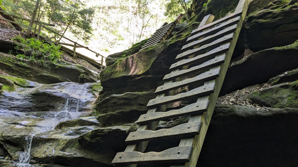
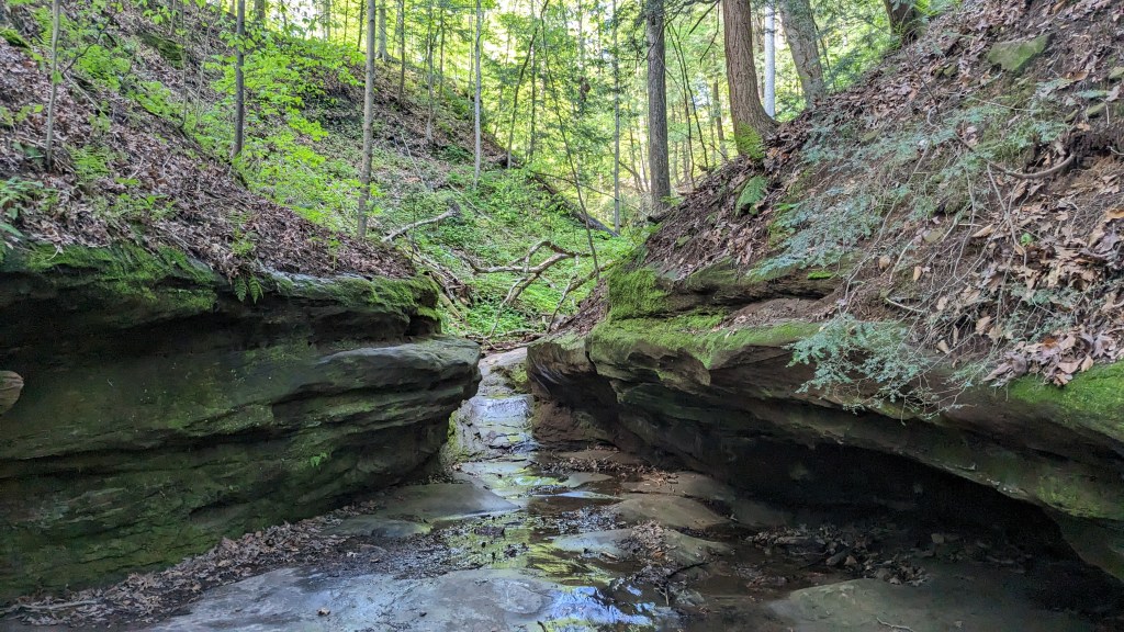
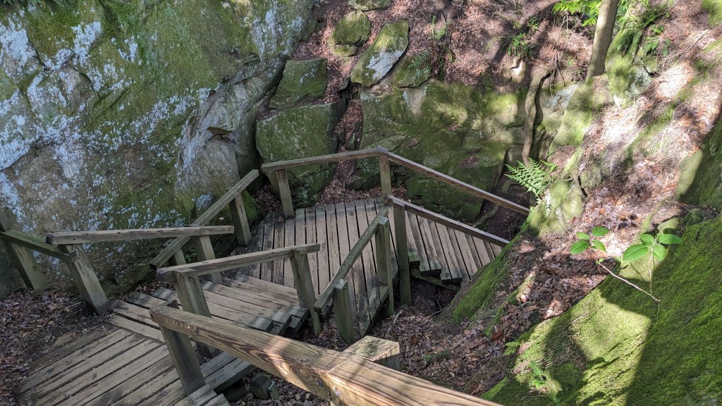
I continued on Trail 10 back to Trail 3 in a different place. From here Trail 3 leads into a new canyon. The entrance to this hollow from this end requires climbing down 3 different wooden ladders. These dropped me into a much smaller space called Bear Hollow. Bear Hollow was much smaller than Rocky Hollow, but that only made it more interesting as the tall rock walls on either side were only about 10 feet apart at most.
Coming out of the Hollow, I was once again back at the water’s edge. I turned right and headed for the western edge of the park or at least as far west as the trails go. In a unique grove of fir trees at this end of the park I suddenly came across a small black snake about 3 feet long. He was right in the middle of the trail and in no hurry to move off. I just stopped and watched for a few minutes, then slowly walked to the side of the trail and gave him lots of space. He didn’t look scarry, I just didn’t want to disturb his afternoon.

I soon came to Trail 9 which led very steeply down into what was labeled Boulder Canyon. An old set of steps was in pieces and looked very unsafe. I hope they have a plan to replace it at some point. Down in this canyon, there was a beautiful waterfall to the right where the water enters. It was at least 20 feet high. Luckily, that was not the way out this time. Instead a wall of 2’ round boulders was my journey to the top. It is definitely how the canyon got its name. Once I was at the top of the boulders, a staircase led to the top of the ridge. I just got to the top when 20 feet in front of me was another staircase leading down into the next ravine. I could see across it to the staircase that led back up the otherside. Climbing up and down and up again, my fitbit thought I was trying to do a 20-minute high intensity activity and started timing me.
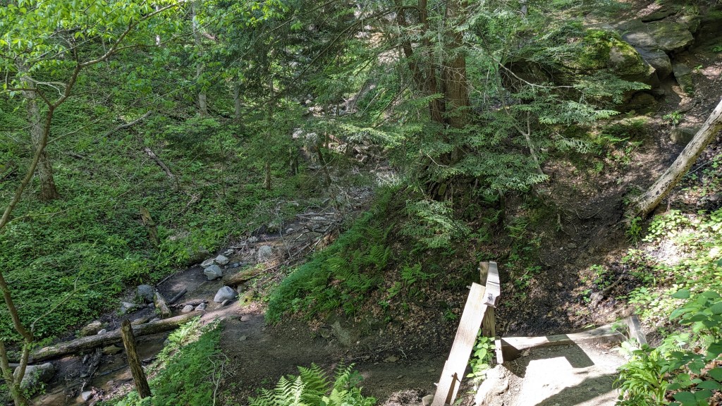
After I made it up and down and up again, everything leveled out to a nice flat trail similar to Trail 10. I took the next right onto Trail 5 which made a very slow descent back toward the water, this time following the ridge instead of down in a hollow or canyon. Soon, I could see the water and had another set of steps built into the hill down to meet the trail in this fir grove where I had started Trail 9. I took a left and backtracked toward Trail 3. Then I continued on along the water back toward the center bridge. At one point, I came to another feature called the “Ice Box” which I mistakenly climbed down into, only to realize the trail actually turned left and went up and around it. More extra climbing.
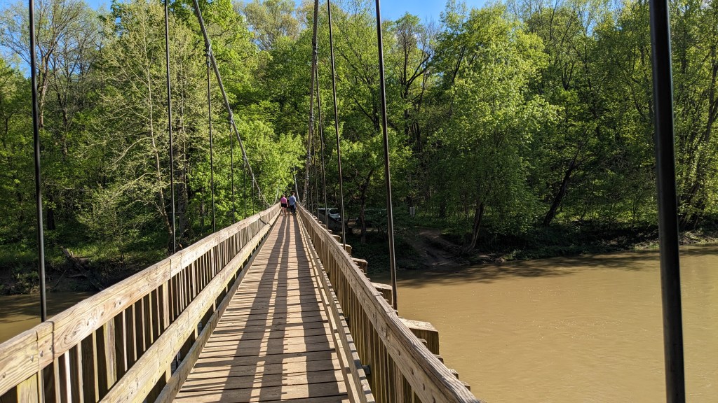
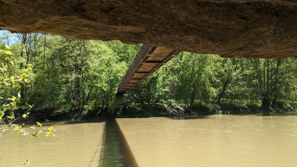
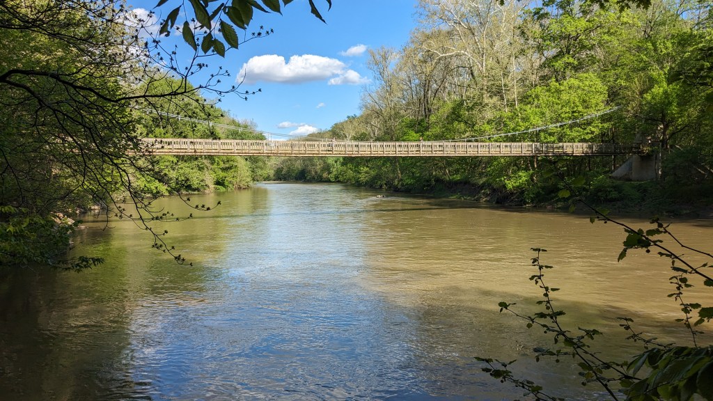
I finally got back to the center bridge. This bridge is a suspension bridge just wide enough for a person to walk across. It is almost 50 feet across, which makes it impressive to see and to cross. Earlier I had hiked under it right along the water. This time, I took the stairs up to the bridge and walked across as it bounced with every step. At the other end was a stone wall which held that end of the bridge. And then the cables went through loops and down to large concrete anchors in the ground. There were 4 Department of Natural Resources (DNR) vehicles here, three vans and a pickup. They had taken the fire road right down to the bridge. I assume they brought tourists, or a specific tour, this far and then let them hike over the bridge to the north side.
I had to walk in the mud to get around one of the trucks because it was right in the middle of the road. I soon recognized where I had come down the hill from the parking lot back when I started. I also realized this is where the DNR trucks had come from to get to the bridge. I walked back up the hill and back to my car. When I checked my fitness app, I had gone only 8.5 miles but it took me exactly 4 hours. There was a lot of slow going as I climbed and maneuvered my way through the many features of this wonderful park. I was not disappointed though. It was just as fun, interesting, and beautiful as I remembered it.

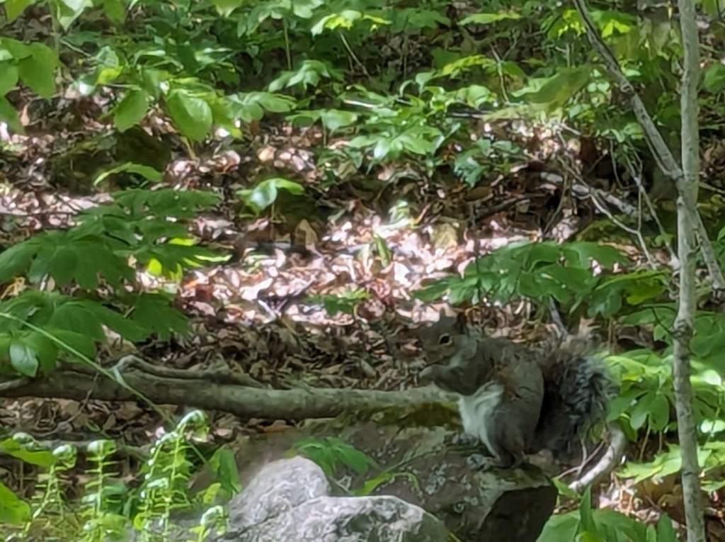
I didn’t mention a lot about the animals or birds. While this park offers so much in the way of unique formations and scenery. There were plenty of animals and birds too. I saw a snake, a tiny lizard with a blue tail, a few chipmunks, many birds, and many many many squirrels. I even saw them in pairs sometimes which was unusual compared to my other hikes. Even driving the half mile out of the park, I nearly ran over 3 or 4 as they darted in front of my car.. I saw so many squirrels that I wonder if they are having a problem with them. Perhaps they will have to rename the park Squirrel Run.
