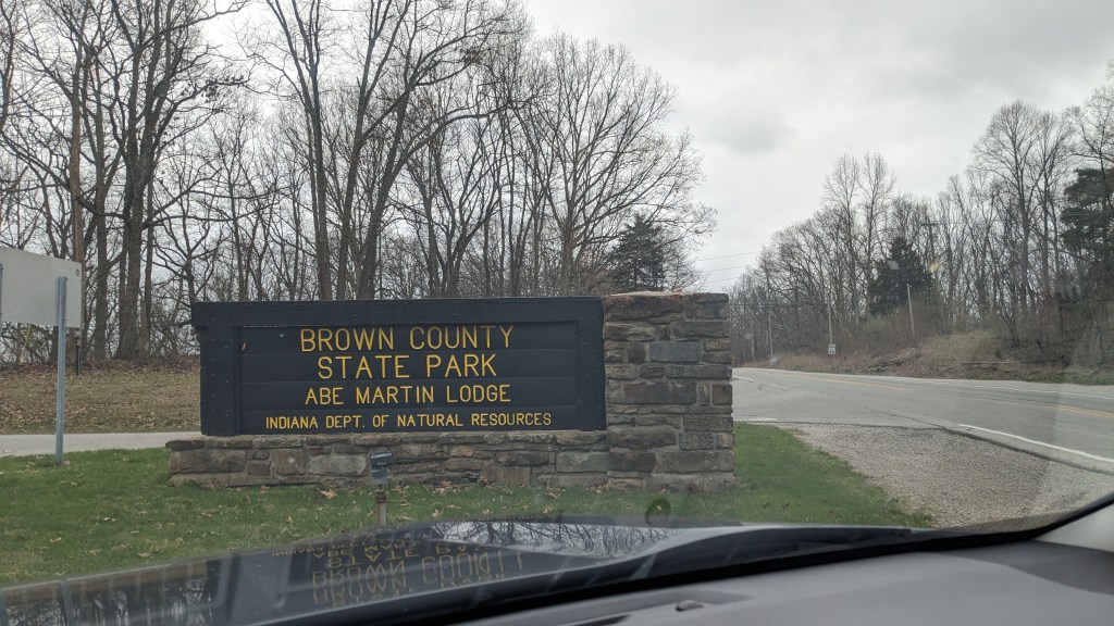
It was a cold cloudy day. Of course it was, the first day of spring is tomorrow. Despite being cold, it was my chance to hike on a third consecutive Monday. I didn’t want to give that up. So, I headed out to Brown County State Park, a park I have visited and camped in many many times as a child and youth. My family camped here often, and my Boy Scout troop camped and hiked here on multiple occasions. I probably know this park about as well as I know any Indiana State Park. Despite the cold temperatures and unsure weather, I was excited to return.
Name: Brown County State Park
Location: 1 mile east of Nashville, IN
Established: 1929
Size: 24.65 square miles
Known For: Nicknamed the “Little Smokies” because of the area’s resemblance to the Great Smoky Mountains NP. It is the largest of the State Parks and a must see destination for fall colors.


The Day
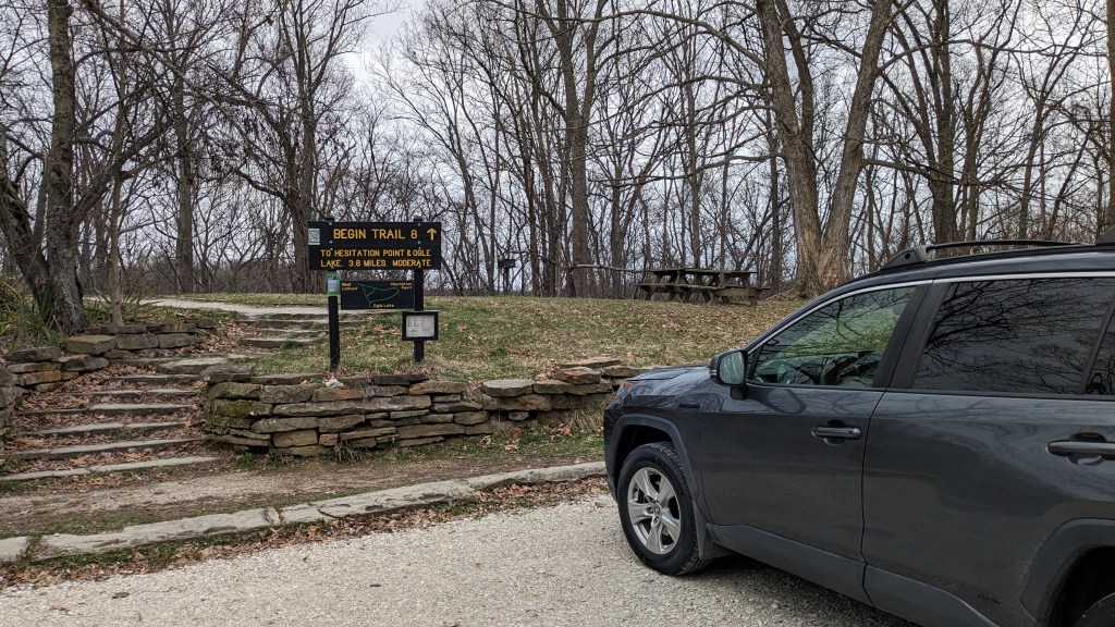
I stopped to get gas on highway 46 about 10 miles east of the park. The wind was blowing at least 20 mph, and I thought I was making a huge mistake going out in this weather. My hope was that the tree-filled forest would not be so windy despite their lack of foliage. I drove around the outside of the park and entered the West Entrance, since I wanted to park and start my journey from the West Lookout parking lot.

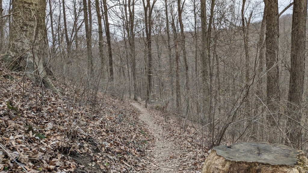
To understand what hiking in Brown County is like, you have to understand that there are 2 levels. The central spine of the park is the main road leading back to the campgrounds and visitor centers. At times, this spine is large and wide and flat, and at others it is the width of the road with steep ravines on either side. The road leading to the west entrance stays on a finger of this spine and is part of the upper level. The many ravines on either side of the main road lead down to lakes. My hike today started on the upper level road then down to Lake Ogle, then up to the Rally Campground, back down to the lake and eventually back up to the west entrance. It’s not high enough to be mountains, but anyone living in the mountains would recognize the foothill quality of this landscape.
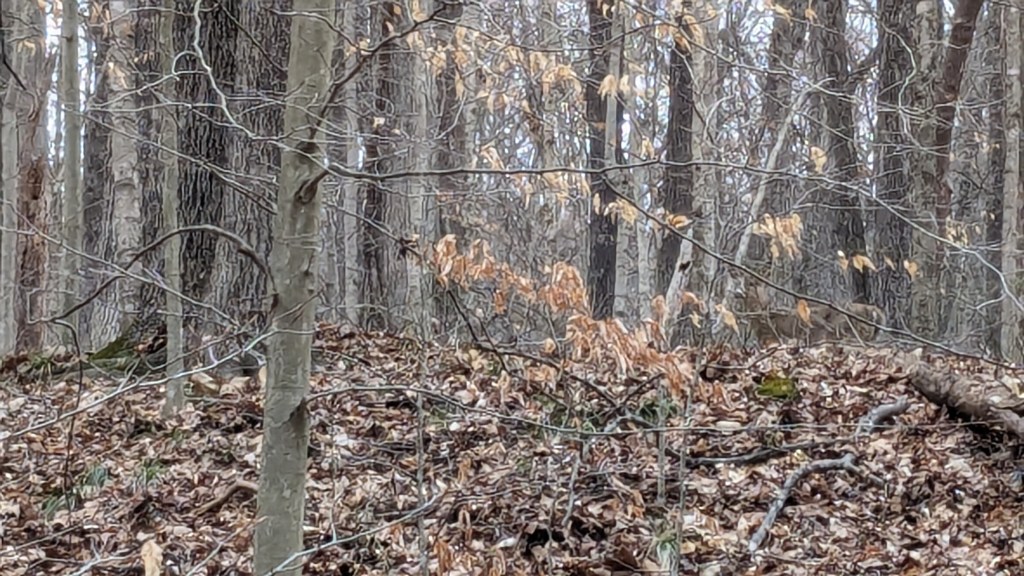
As I began my hike, I was happy that the wind, indeed, was much calmer in the dense woods. It was still cold though at around 35 degrees. I shivered for a time after starting. I had a stocking cap on, so I knew that would be a big help. I was worried for about the first 30 minutes and was staying attune to how I felt and the cold. Once I climbed a short section out of a ravine, I began to heat up and from that point on I didn’t feel cold. I even unzipped my coat and removed my cap a few times after some of the bigger climbs.
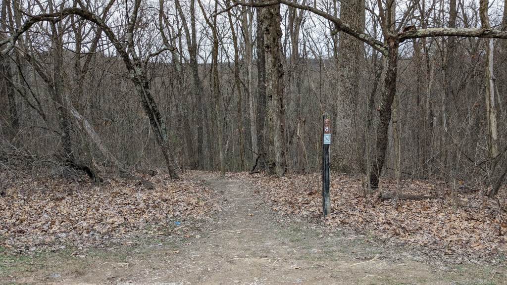
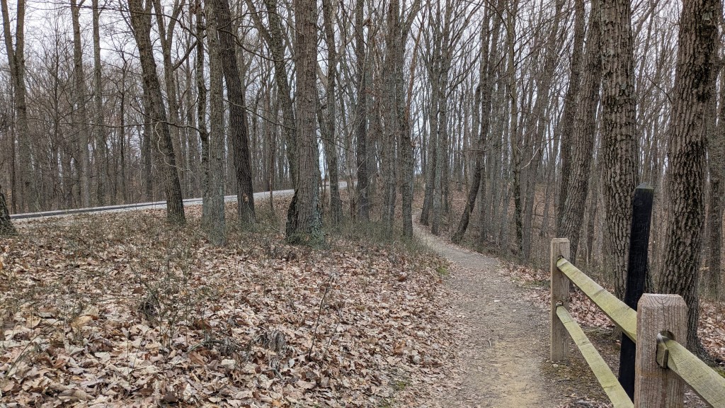
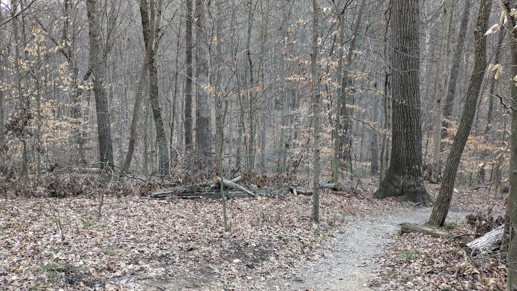
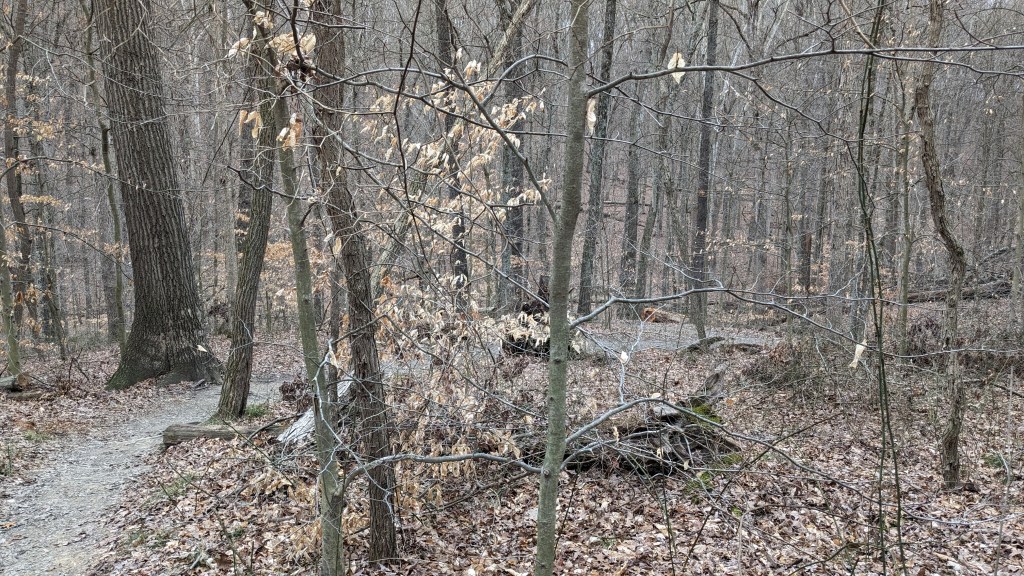
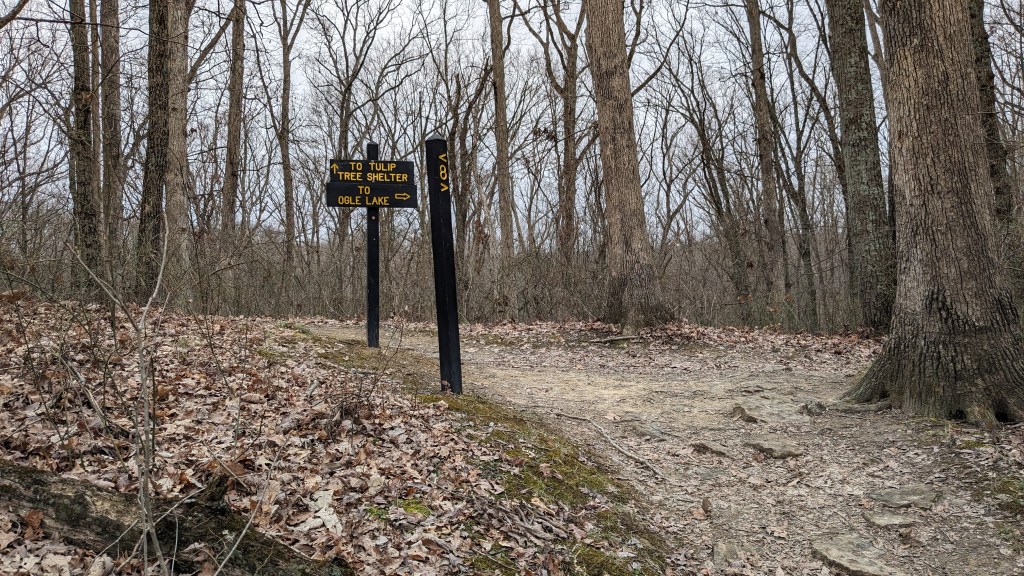
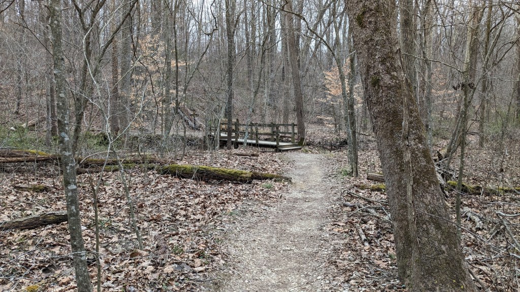
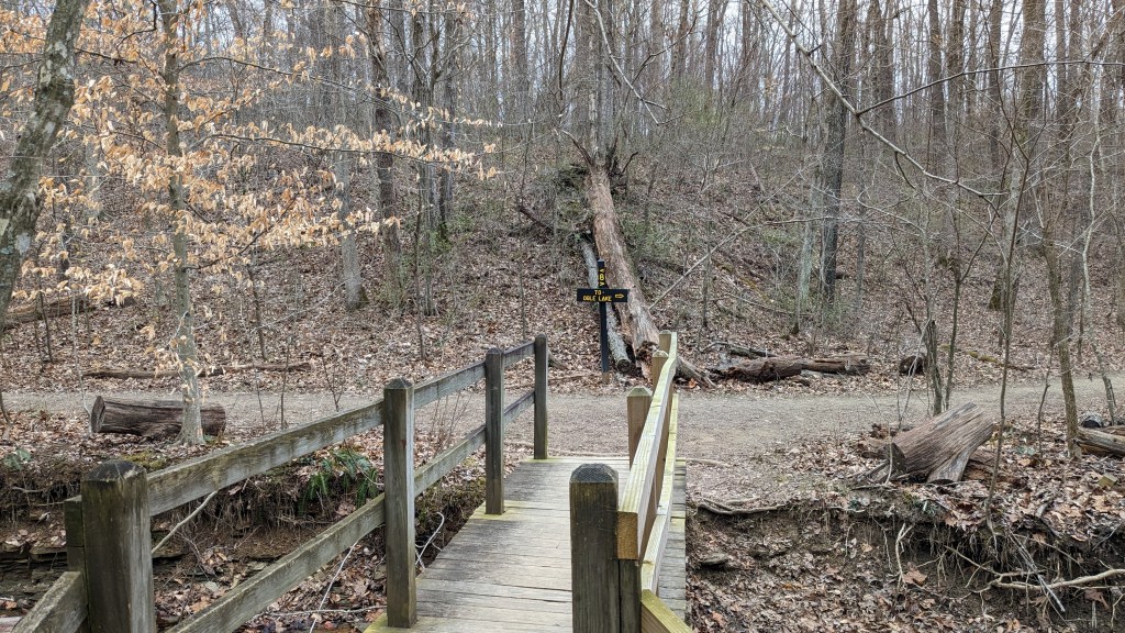
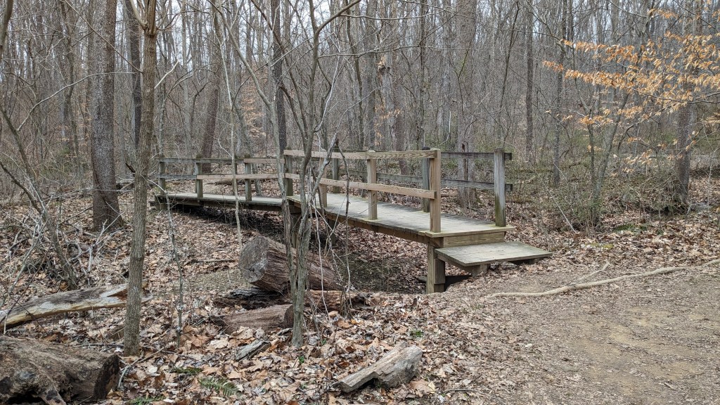
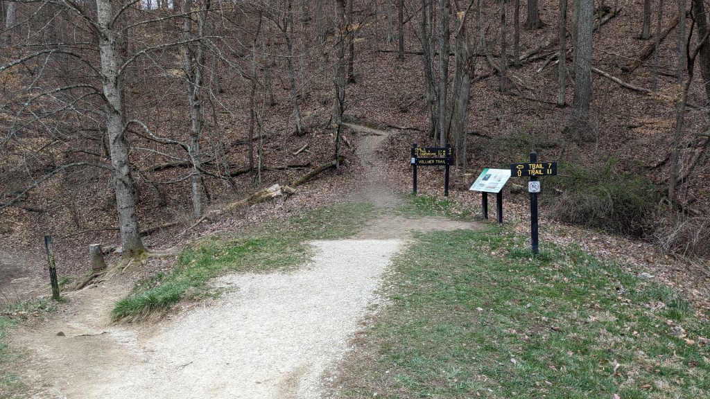
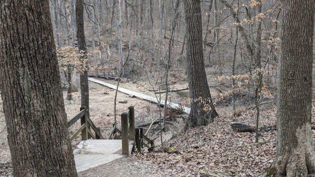
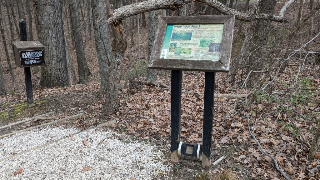
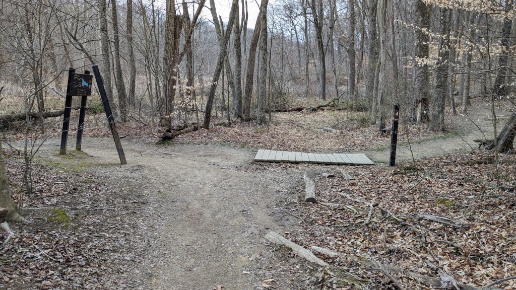
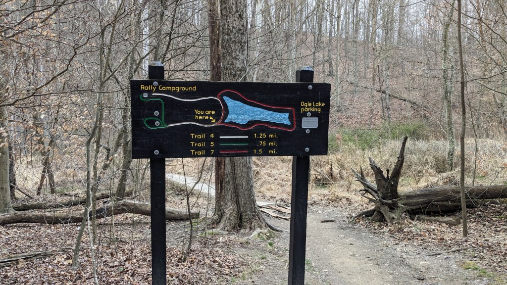
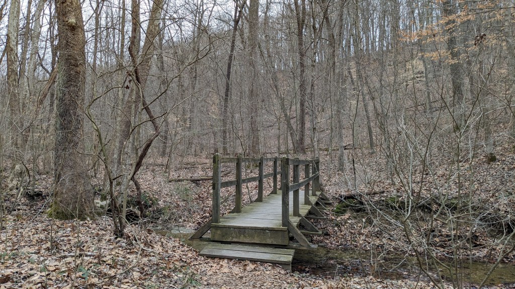
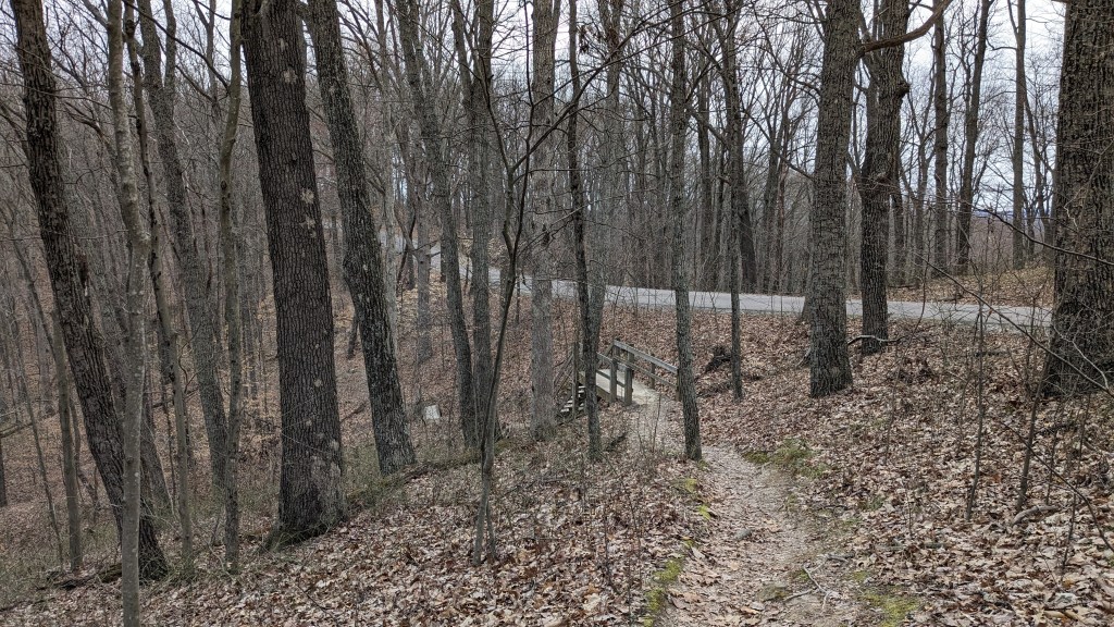
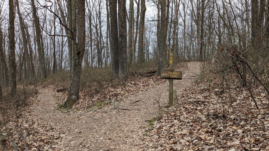
Trail 8 is a 3.7 mile loop with the West Entrance, and Ogle Lake being two of its way points. I took the short way to the lake which was counter clockwise. The trail had great signage and was easy to follow. There were small wooden bridges even over the smallest of streams, and despite the recent rains, the trails were all in great condition. There are ups and downs despite the overall drop from the West Entrance to the lake. Over all this section, it was an enjoyable, silent, and isolated hike. The cold, I think, was keeping even many birds cuddled up instead of out making noise.
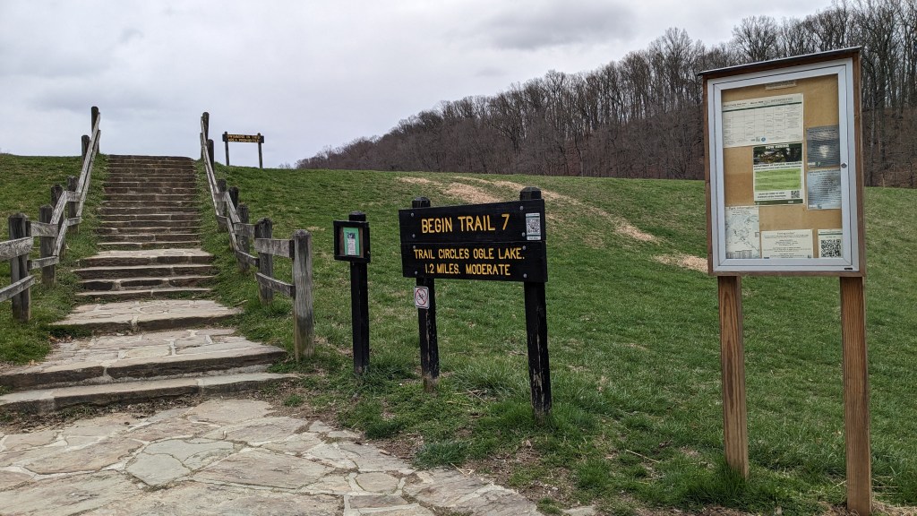
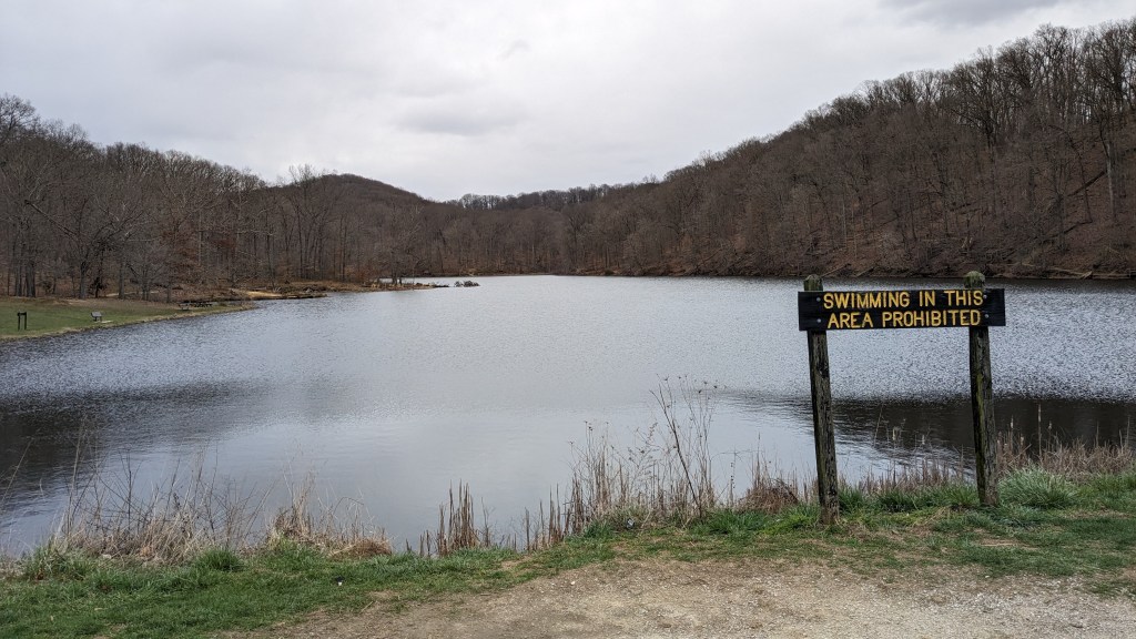
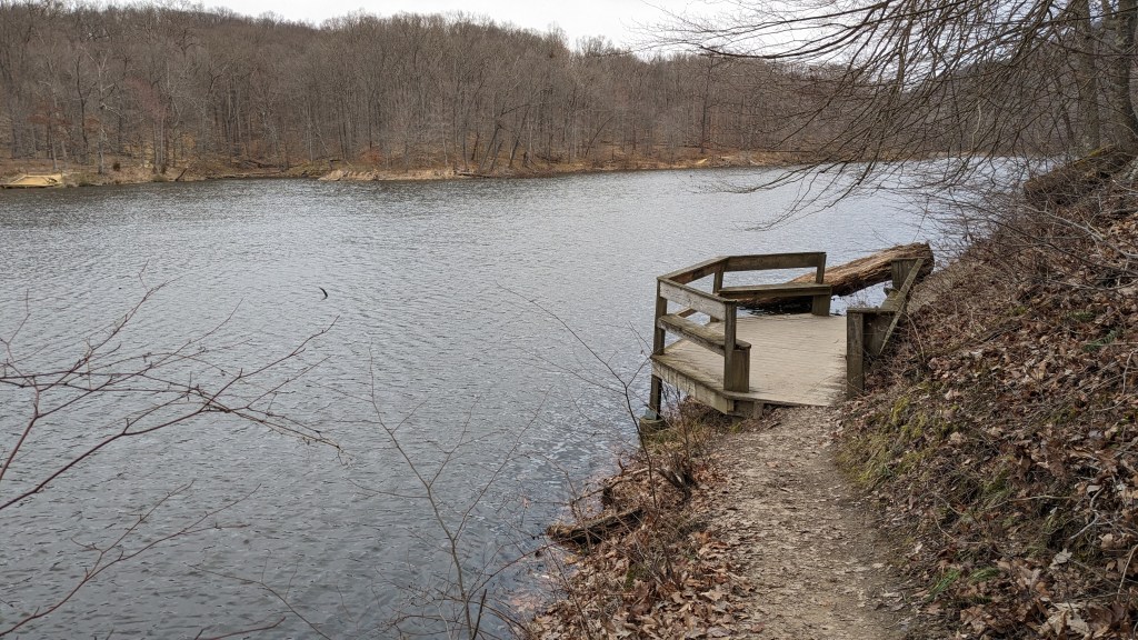
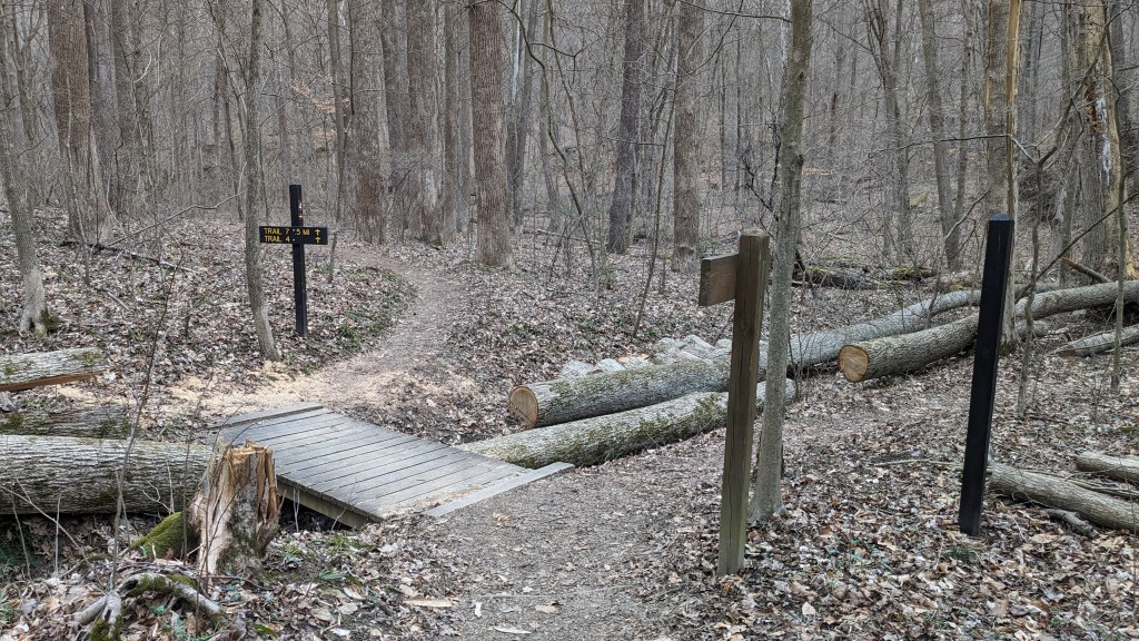
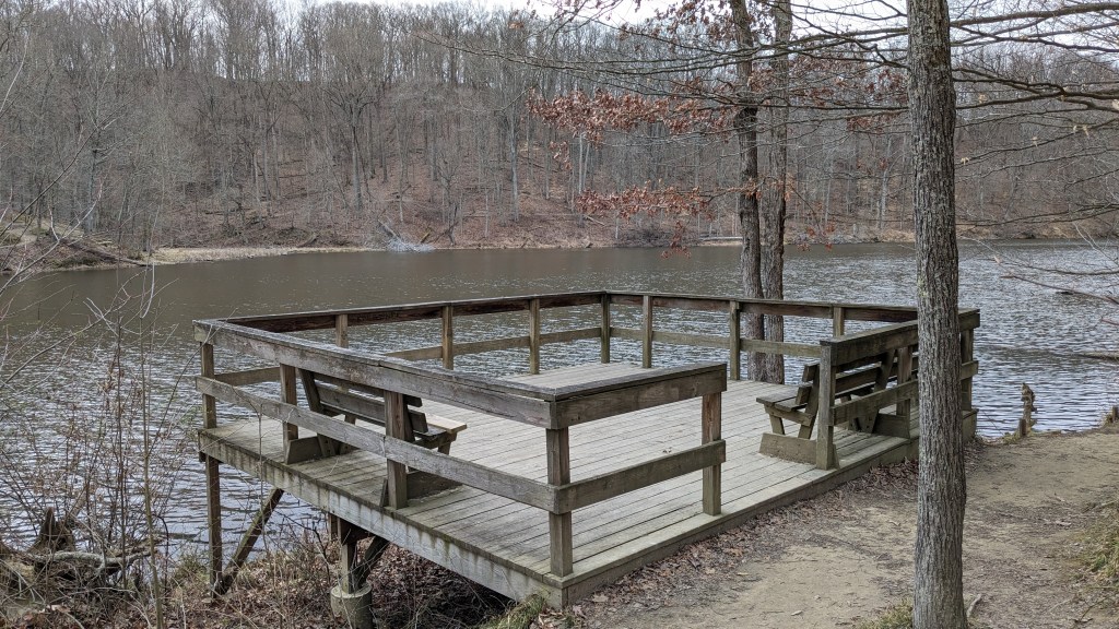
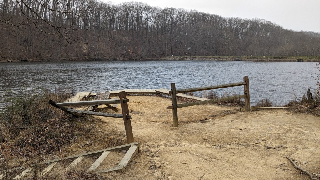
I reached the lake and saw 2 cars, but no people. I changed to trail 7 which is a 1.5 mile loop around the lake. I have hiked this trail many times in my life. Once I hiked part of it with my wife, Jennifer, when snow was on the ground and the lake was frozen. It was not nearly as cold this time. Even though I knew my way, I was again pleased to see that trail 7 was clearly marked and had lots of wooden steps and bridges to help with the harder to navigate areas. I started the loop at the dam side with the spillway and overflow pipe, then I hiked halfway around the lake.
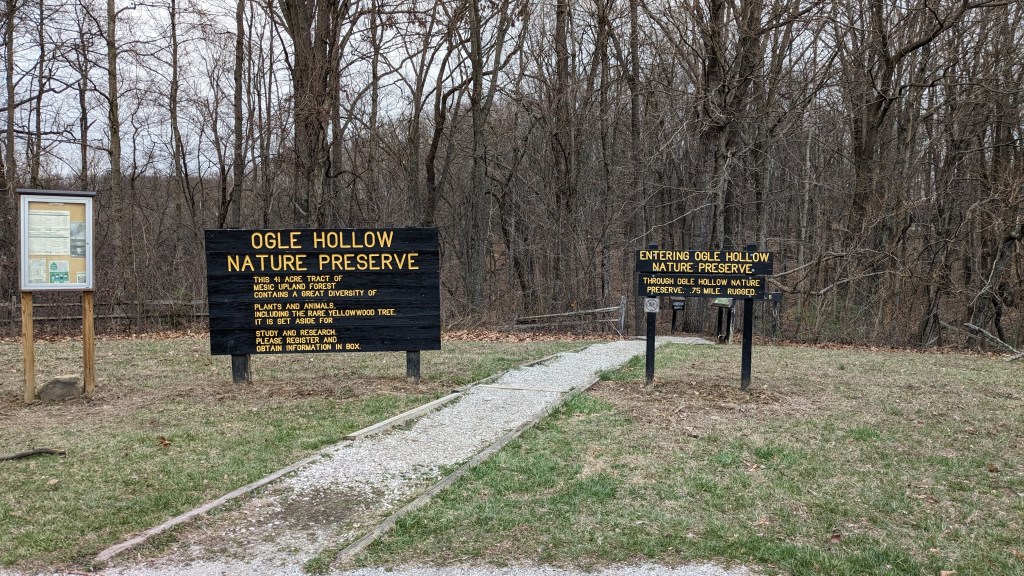
There are 2 inlet streams feeding the lake. In between the two creeks is a high ridge which leads back to the Rally Campground and the main road at the center of the park. At this point, I changed trails again to trail 4 which is sort of a loop back to the campgrounds. It was on this trail that I finally saw people, as well as wildlife.

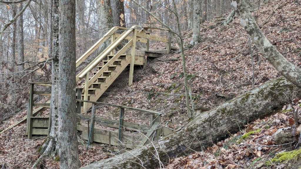
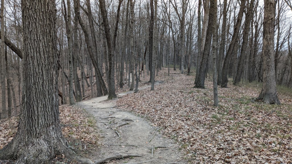
I hiked all three trails in a counterclockwise direction. I was especially glad that I hiked trial 4 in this direction. The climb up from the lake to the top of the ridge was partially stairs, and partially a moderately steep trail. The climb started almost immediately after leaving trail 7 and I was soon at the top of the ridge. From here, trail 4 followed the ridge to where it widened out and the campground started. It skirted the campground and then came out at the entrance to the Rally Campground.
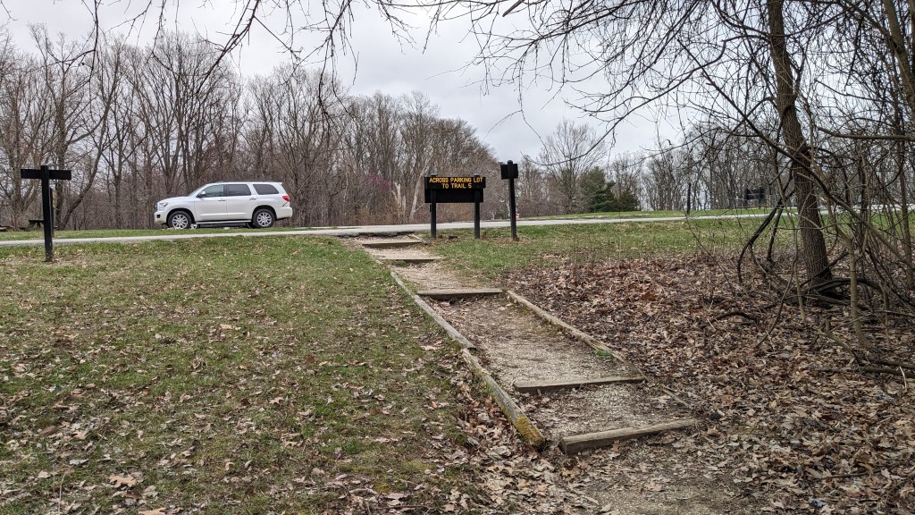
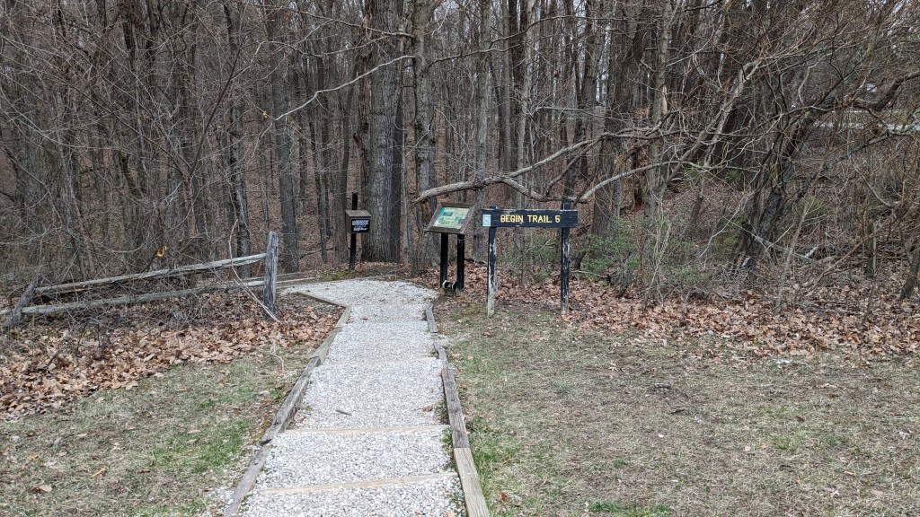
The signage once again was great as it led me across the road to the start of trail 5. In the trail numbering on the map, trail 4 doesn’t actually make a complete loop. Part of trail 5, which is a nature trail, serves as a small section of the loop to complete trail 4. This was all clearly labeled both in signage and on the map I was using. This part of trail 5, however, is a very steep unwavering descent down the other side of the ridge. This was why I was glad I had hike trail 4 counterclockwise; hiking down this section was much easier than hiking up would have been.
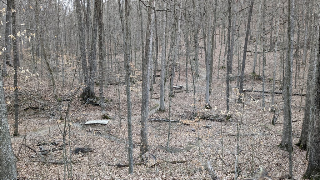
At the bottom, there was once again clear signage leading me to trail 4 and my journey back to the lake. The first half of trail 4 climbed up to the top of the ridge. On this side, trail 4 spent all of its time at the bottom following and crossing a small creek several times as it led me back to the lake. I saw more people in this section than anywhere else. Despite that, it was the one place I saw the most animals as well.

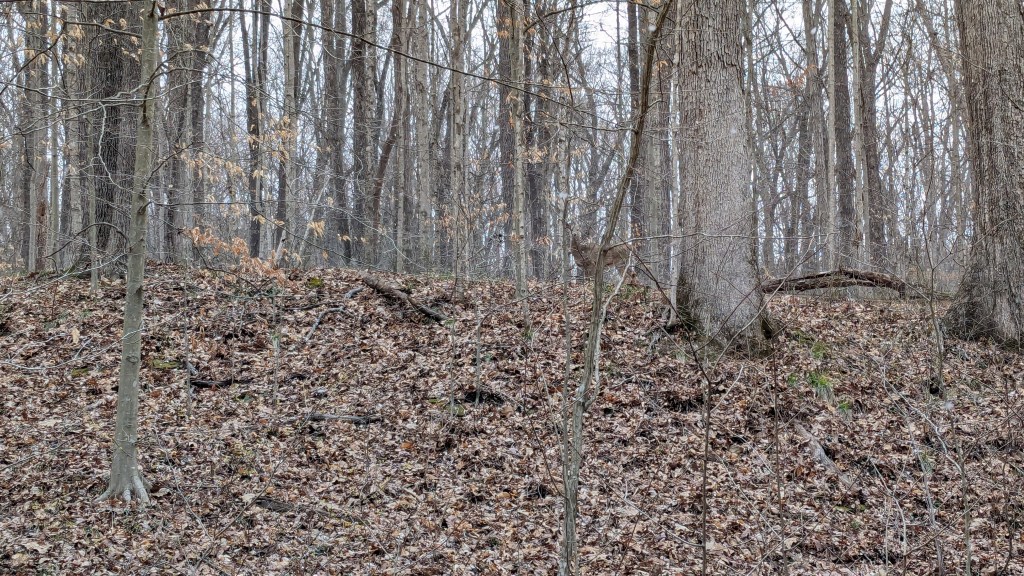
Hiking along trail 4 snow began to fall. It was not heavy at first and I think the air temperature was probably still not quite freezing, so the snow was icey. The small ice crystals landed on my dark blue coat and made it look like it was bedazzled. At one point, I stopped to take a picture of it and heard a large branch snap behind me. I turned to see a doe looking at me. She wasn’t scared, just curious. I was able to get my phone out and take a picture or two before she moved on. She was followed by another as they made their way back into the woods foraging for food. This was the first deer I had seen while hiking since Deem Lake last summer. I have been surprised at how few I have seen in all of my hikes.
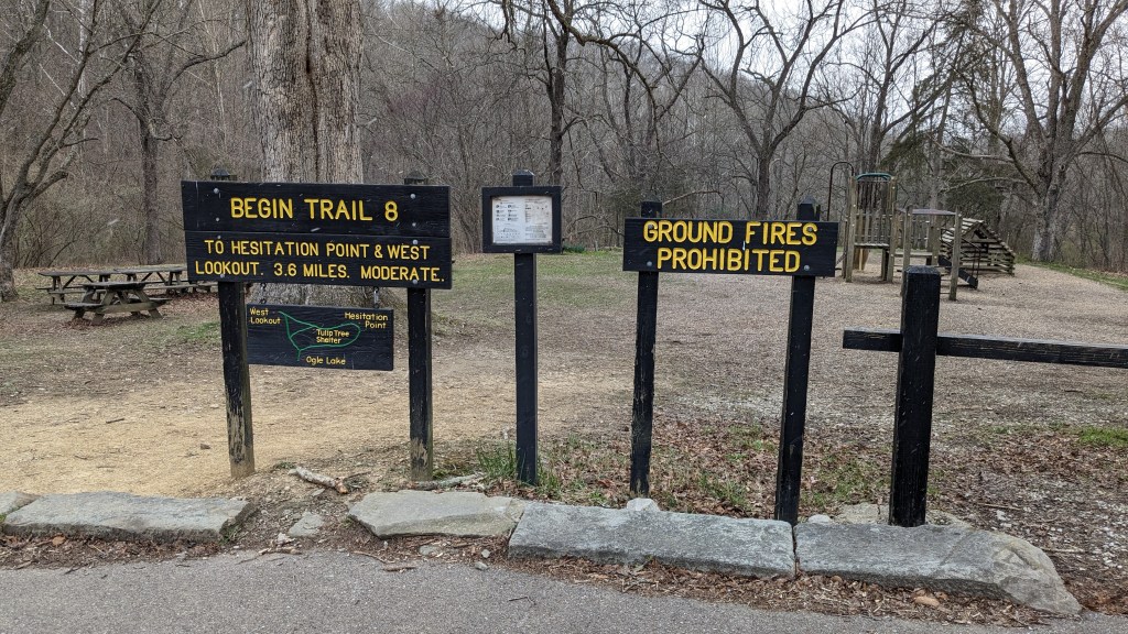
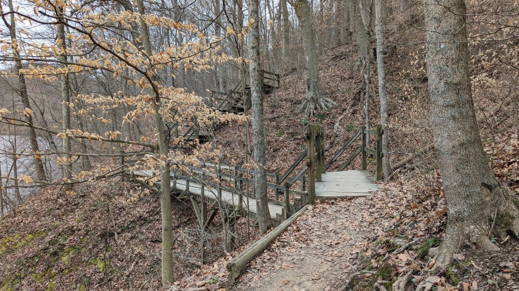
The snow got a little heavier as I returned to Ogle lake and finished trail 7 back to the dam. By the time I got that far, however, it stopped completely and didn’t return. After I crossed the parking lot, I had a choice to make, take the short way back to the car or complete the full trail 8 loop. I was no longer cold and still ready for a challenge, so I continued the counterclockwise trip around trail 8. From here, trail 8 was fairly flat following another creek as it made its way. Logic told me that I was traveling uphill as I made my way toward the center of the park, but any incline was hard to perceive. This, of course, meant that at some point I was going to have to make a large climb.
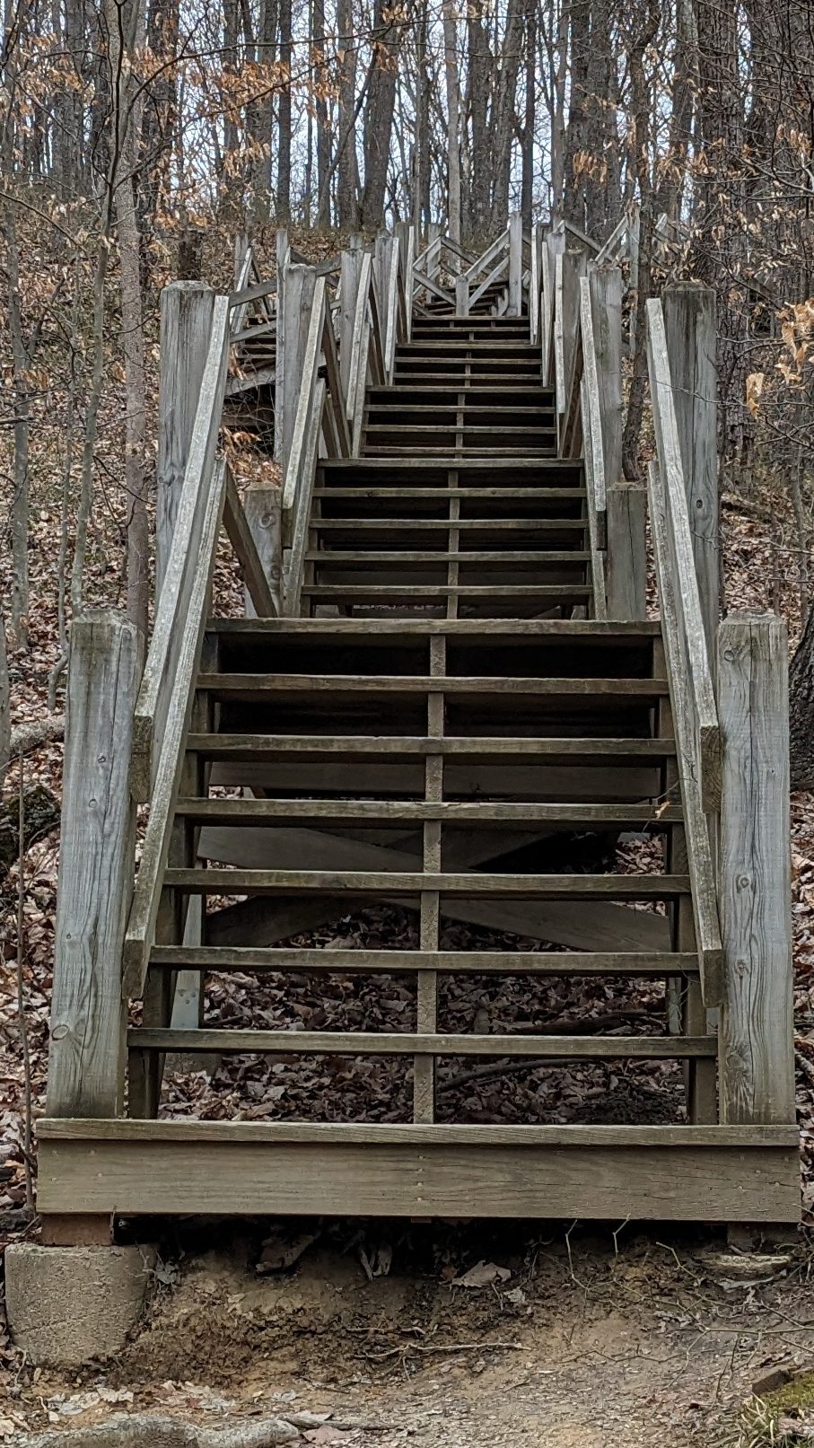
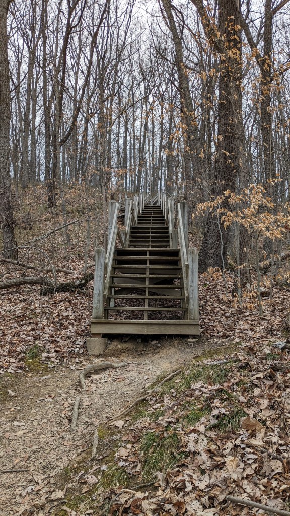
Sure enough, after a fair distance, the trail crossed the creek one last time and in front of me were stairs and more stairs and then a right turn that I could see up through the trees led to even more stairs. I should have counted them, or made a video of climbing them. They went on and on for some time. I kept reminding myself of how hard the trail would have been without them, so I didn’t complain too much. At the top of the final set of stairs, I encountered the first and only thing I could complain about all day.
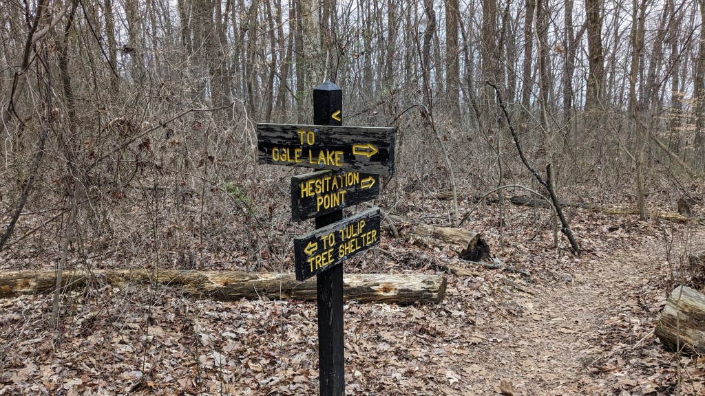
The trail from the top of the stairs led in two directions and there were zero signs. Nothing to point me in the right direction. The map was also of little help as it did not accurately show this section. I actually started off in the wrong direction and then after a minute realized I was not circling back to where I needed to be. After such good signage everywhere, I was really disappointed to see none here where it was actually needed.
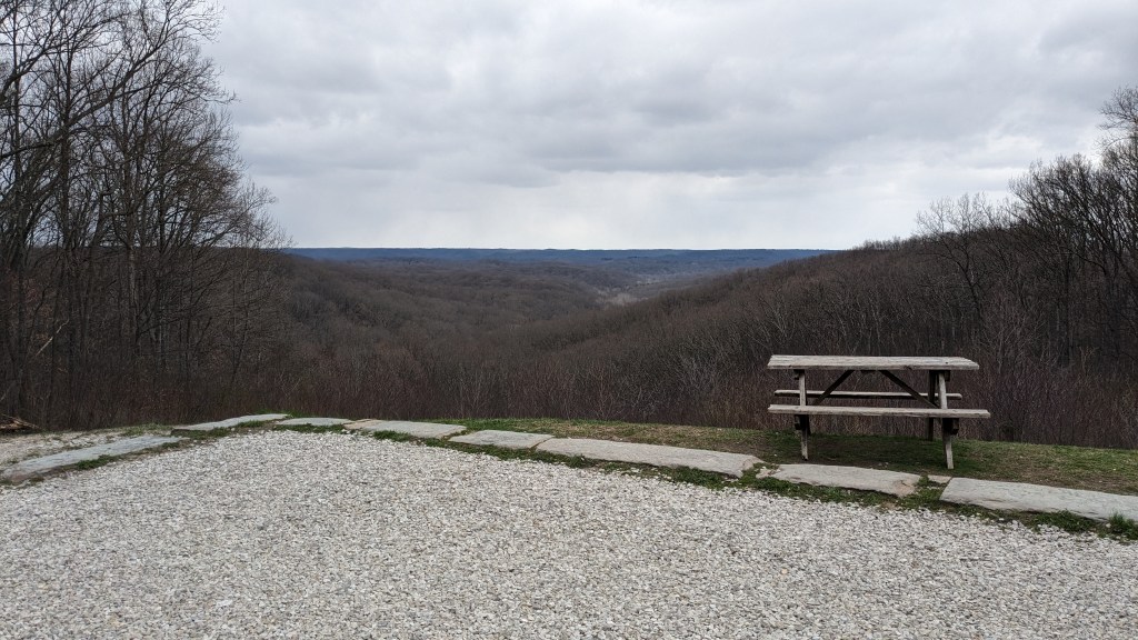
So, I turned around and headed off in the right direction, which I was only sure of when it came to the road and what I was trying to find.. This is the most famous location in the park. A turnout with a view that extends for miles. This is where people come to see the fall colors as they spread out for miles to the north. This is called Hesitation Point, aptly named because you feel called to stop and stand in awe at the view. I did just that. I crossed the road to the vista and rested not only to enjoy the view, but also to recover from all of the stairs I had climbed just a few minutes ago.
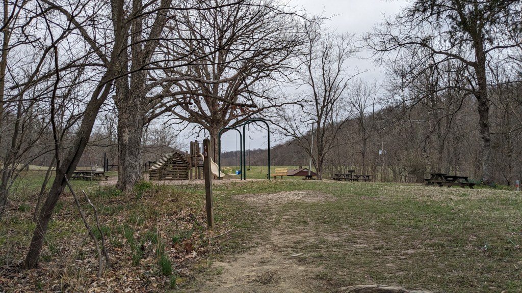
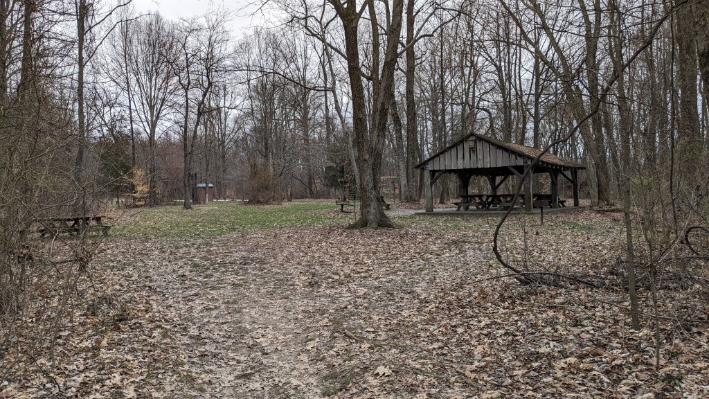
From here, trail 8 follows the road back to the West Entrance. There are picnic spots along the way. I can remember stopping at some of them for different events from my childhood. Despite the relative ease of this part of the hike, it was still farther than I expected back to the parking lot where my car was. I kept thinking just over that hill, and then another, and another. Eventually I caught sight of the small wooden lookout tower and the trail came right back to where I started. All in all, I calculated that I hiked around 7 miles. That was the farthest that I have hiked since starting this project. I suppose the cold temperatures made it easier to hike farther without feeling like I was drained. Brown County is beautiful even on a cold and cloudy gray day. It was also a win for viewing nature as I got to see two deer and two bright red cardinals.
