Almost on the spur of the moment, I decided to head out and visit Clifty Falls State Park. It was afternoon before I left home, but I had no doubt that even with the time change I would have plenty of time to enjoy the scenery. It was a 45-minute drive along country roads and 2-lane highways there and back, but well worth the trip. You arrive on Clifty Hollow road which leads to Clifty lane along Clifty Creek and Clifty Inn. Everything here is Clifty.
Name: Clifty Falls State Park
Location: 5 miles west of Madison, IN
Established: October 1920
Size: 1,519 acres
Known For: The beautiful 60’ Big Clifty Falls, one of the few State Parks to boast its own Inn inside the park.


My Day

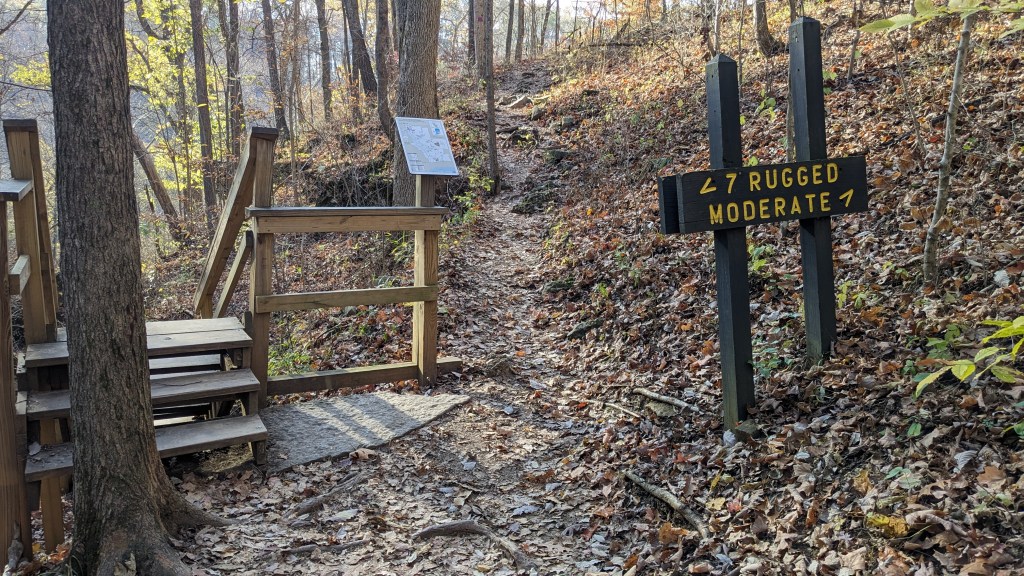
The park is long and narrow. It is one of the few parks with multiple entrances. The entrances are at the north and south ends of the park. Clifty Falls is near the north entrance. Clifty Inn is near the south entrance. Between them, there is a large section in the middle which is divided into two roads. The western edge of the park follows Clifty Canyon and there is a south heading one-way road which follows the eastern ridge of the canyon. Along the east side of the park is a two-way road connecting many of the facilities of the park like the pool and campground.
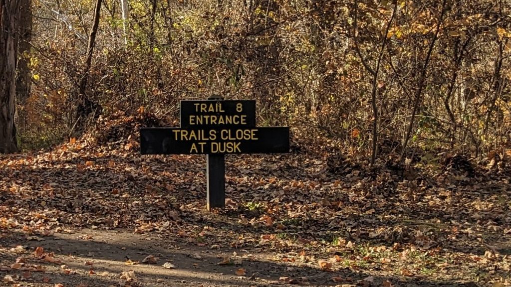
My plan for the day was to hike both sides of Clifty Canyon starting at the northern end of the park and then crossing at a middle section. At the north end, there is plenty of parking. Since Clifty Falls is the main attraction, it is not surprising there is so much parking. There was even parking just for the trailhead of Trail 8 where I started, but knowing that I was making a loop, I parked at the other end of the parking lot, so I wouldn’t have so far to walk at the end of my journey.

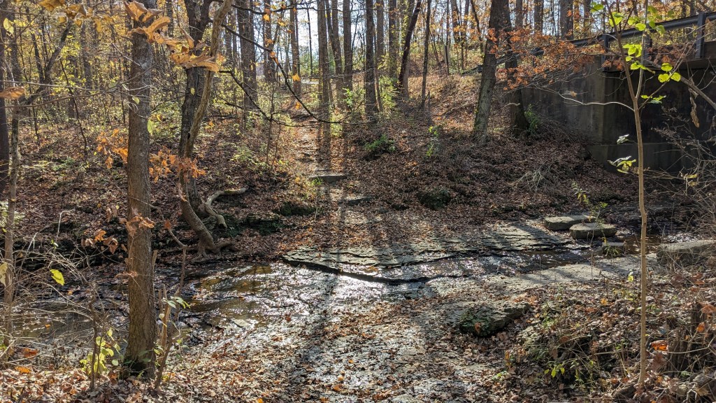
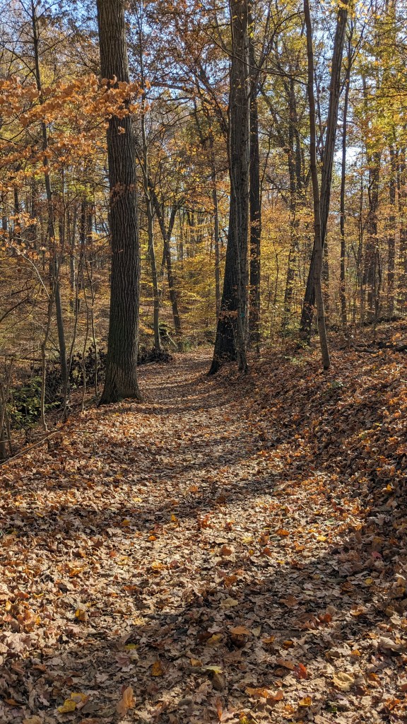
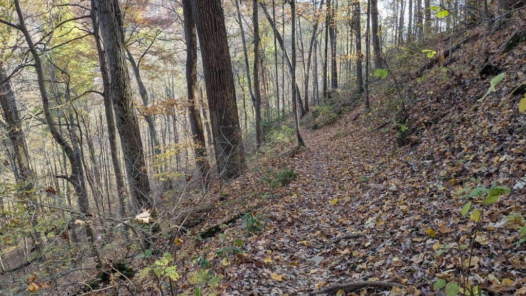
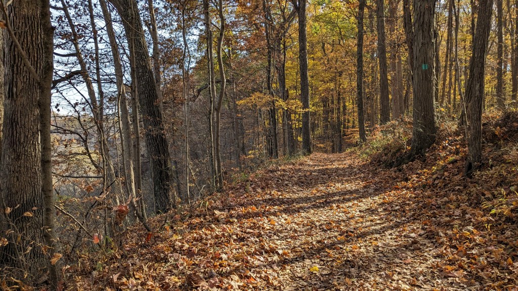
Trail 8 leads at first to the very northwestern corner of the park, just 200 feet from the trailhead. Here Clifty Creek is little more than a culvert under the highway and very easy to cross. Once I was over the creek, the trail stayed on the ridge between Clifty Canyon on my left and the park boundary several feet through the woods to my right. At first, it was a little disappointing that the trail seemed to stay so close to the park boundary. There was no sense of being in the woods. I even saw a few cars traveling up and down the small road which marked the boundary.
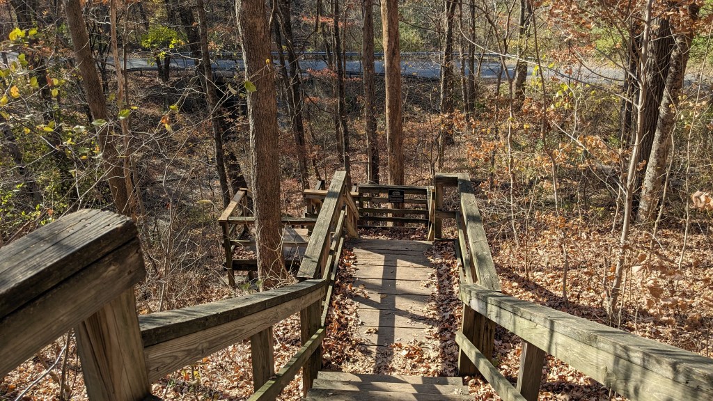
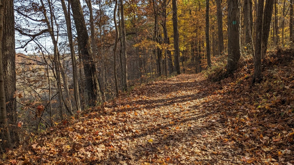
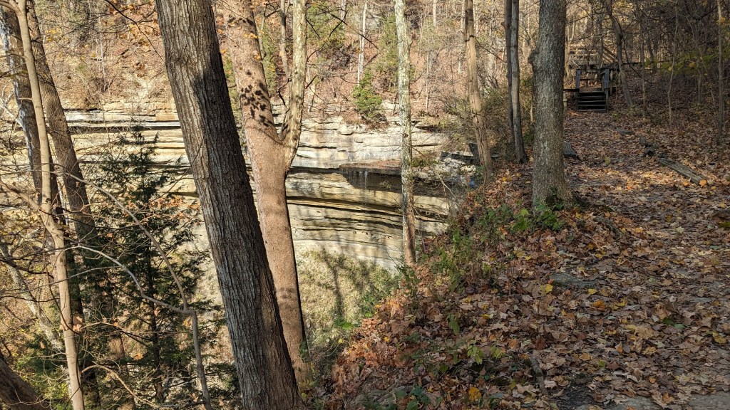
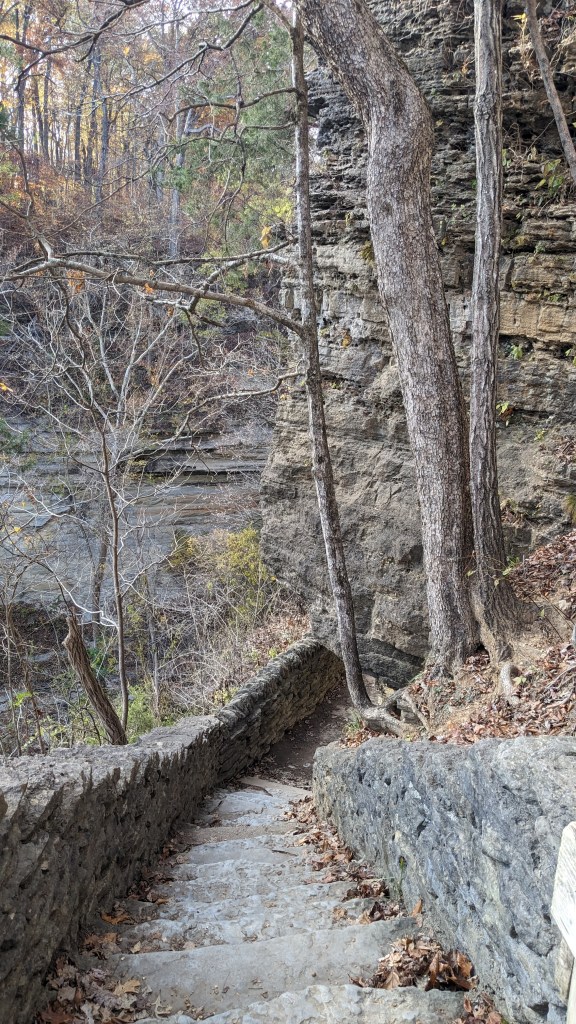
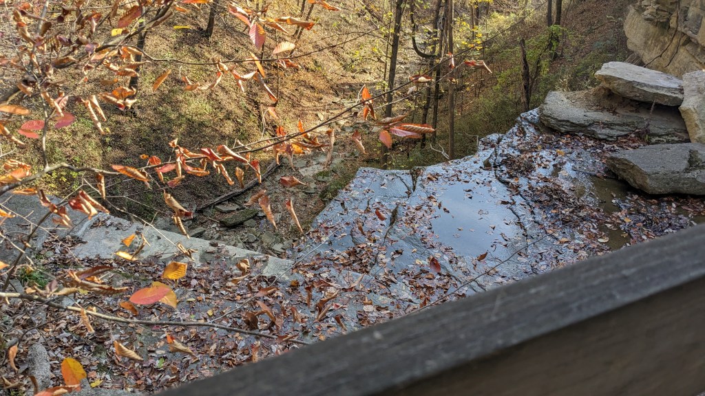
The first thing you encounter on Trai 8 are stairs on the east side of the creek leading down to the creek crossing. Stairs are a prominent part of the trail system throughout the park. Once I had crossed the creek, however, I was on a well-maintained trail that was easy to follow and for the most part pretty flat. The canyon to my left was not very deep, perhaps 30 or 40 feet. While you cannot see Clifty Falls from this side of the canyon, there was no mistaking its location. Suddenly, the canyon that had been slowly getting deeper, plunged to well over 150 feet down. Through the trees, many of which had lost their leaves for the winter, you could see the beautiful east canyon walls. The afternoon sun highlighted their rock outcrops and distinctive shapes.
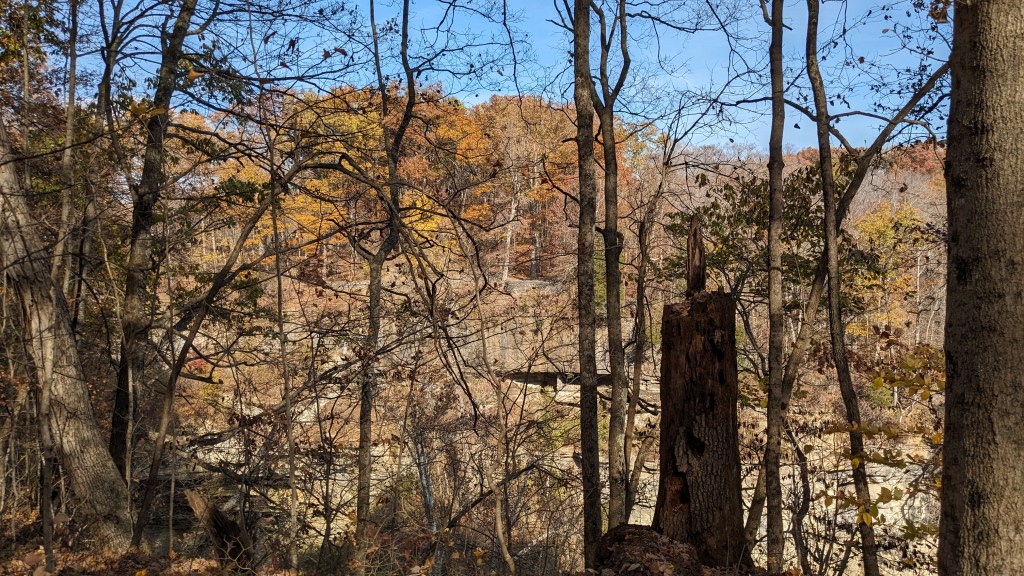
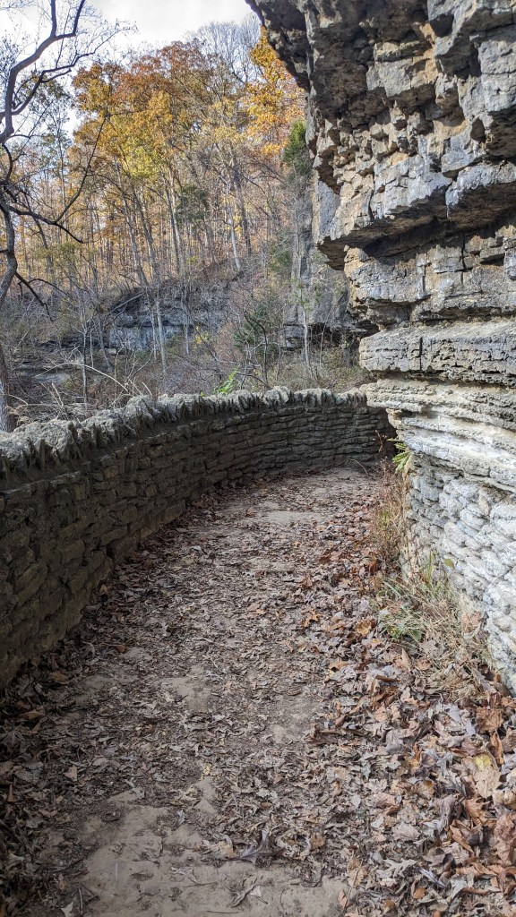
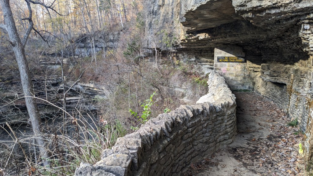
There were now signs warning hikers to stay back because of the steep cliffs and drop offs. At this point, you realize why this park and the creek might be called clifty. The shale and limestone walls carved by centuries of rain and water are very uniquely shaped and make for beautiful walls of stone. They often appear to have been carved by hand, because they are often perfectly perpendicular and intricately carved in patterns that appear to repeat in regular intervals.
The sun at 1:30, when I started, already felt like a late afternoon sun. I’m not sure if the air was hazy, or if it was an effect of the light shining through the brightly colored leaves. It felt like I needed to hurry to be done by dusk, though in fact I had plenty of time. Turning left onto the connector to Trail 2, I got that feeling even more, because the west side of the canyon was already in shadow.
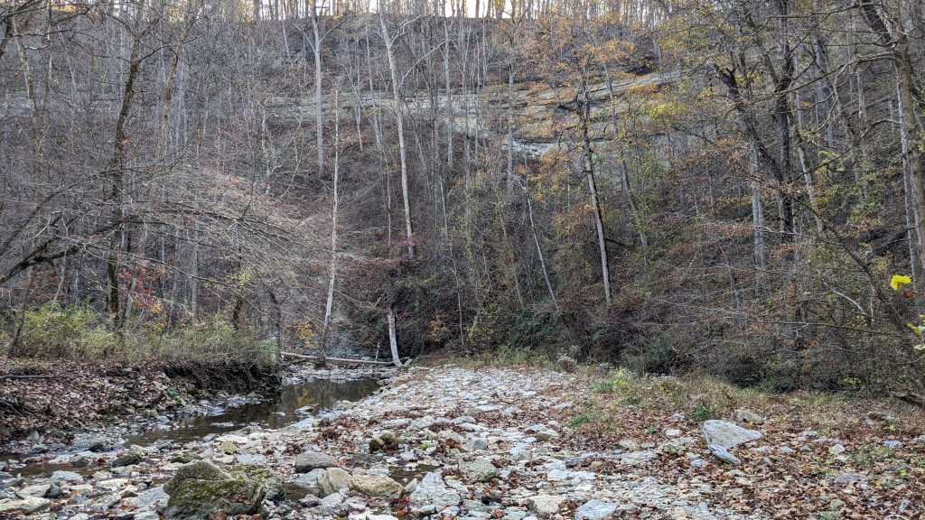
As easy as trail 8 was along the ridge, taking the connector down to trail 2 was much more like a rugged trail you would find in the Sierras, or Smokies. It was narrow and steep. It was still easy to follow, however. I was glad I was hiking down it and not up. Once I arrived at the bottom, the trail was a little harder to follow. Trail 2 starts further south and hikes up to near the base of Clifty Falls. Much of the trail is simply walking up the rocks along the creek. Where there were trails, it was hard to decide if they were there by design or simply by perpetuation of hikers using them. At one point, the trail was so close to a 4-foot-high bank wall that I had to hold onto a tree branch to keep from falling off into the creek below.
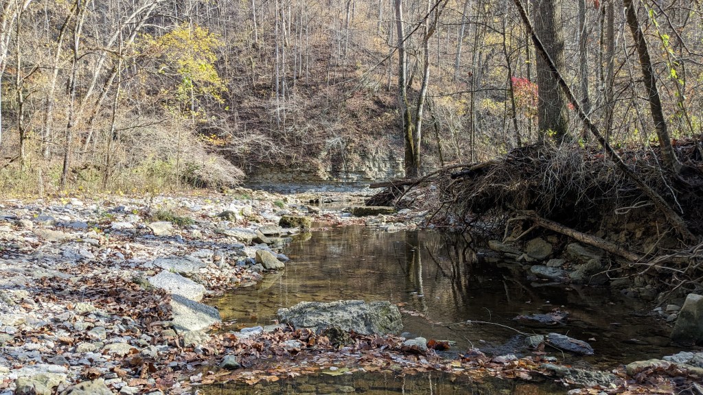
I followed Trail 2 for just a short way, however, it was one of the prettiest points on the hike. Being at the bottom of the canyon, you could truly see how tall the canyon had become since I crossed it at the beginning of the hike. The east side of the canyon was washed in sunlight while the west was cloaked in shadow. As I walked, the shadow was slowly crossing the canyon floor and starting to head up the east side. At a big bend in the canyon was the sign for Trail 5 and my climb out of the canyon on the east side.
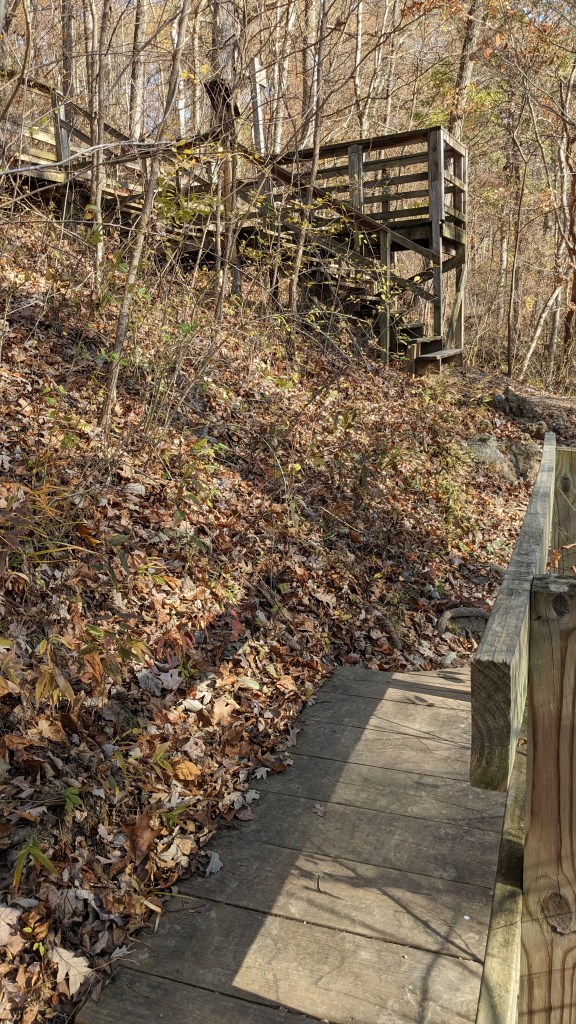
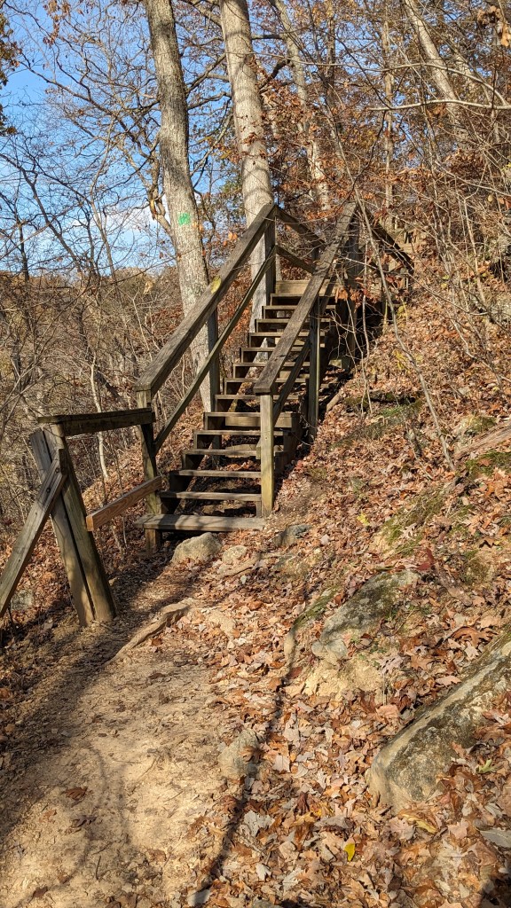
Trail 5 from time to time had sections of stairs and walkways to help navigate the steep canyon walls. Clearly the east side of the canyon was steeper than the west. Trail 5 took me back north as I climbed higher and eventually went into a side canyon. At this point, there were a couple of opportunities to take a side trail and hike up to a parking lot along the road above. From this point on, I would never be too far from the road above. Unlike Trail 8, however, most of the time you couldn’t see or hear the road.
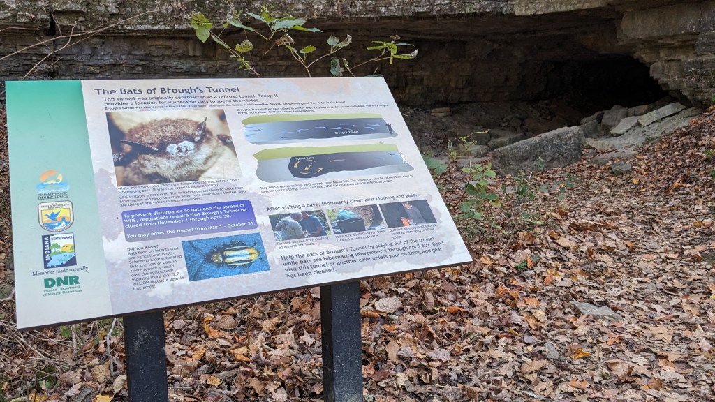
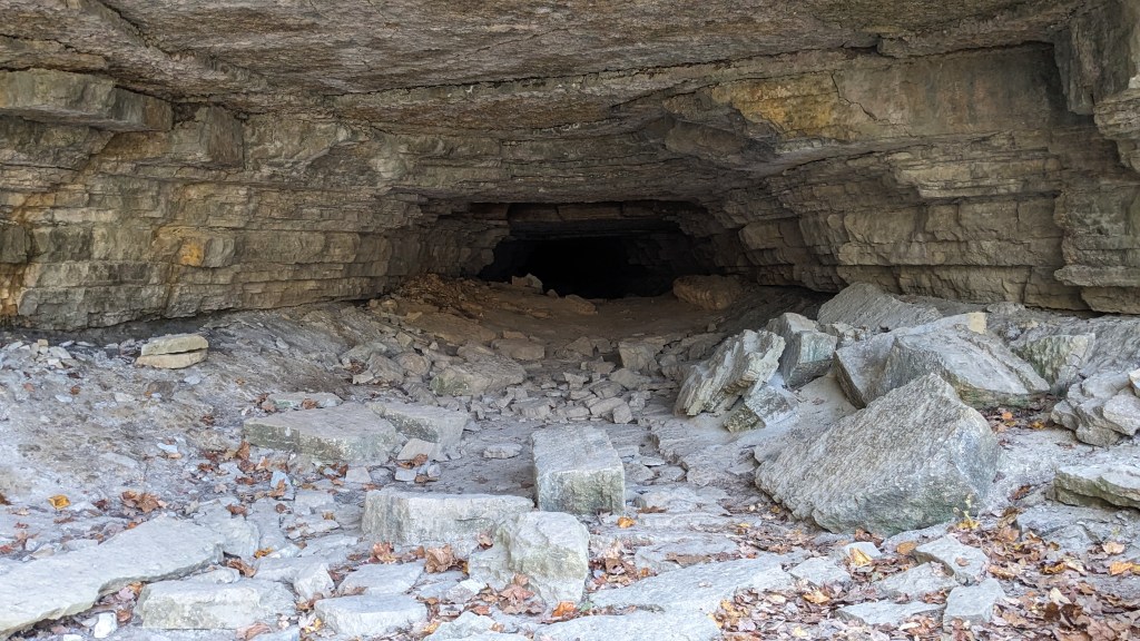
The main feature of Trail 5 is the Bat Tunnel. I was hoping the trail went through the tunnel, but this is not the case. The tunnel is just to the right of the trail. The story is that a local resident tried to build a railroad spur from the Ohio River up through Clifty Canyon to the main line. This tunnel is one of the last remnants of that attempt. I missed the dates that you can walk through the tunnel by a week. Hibernating bats get priority all winter. However, standing at the entrance, I’m not sure I would call it a tunnel. Perhaps next spring, I will come back and see for myself.
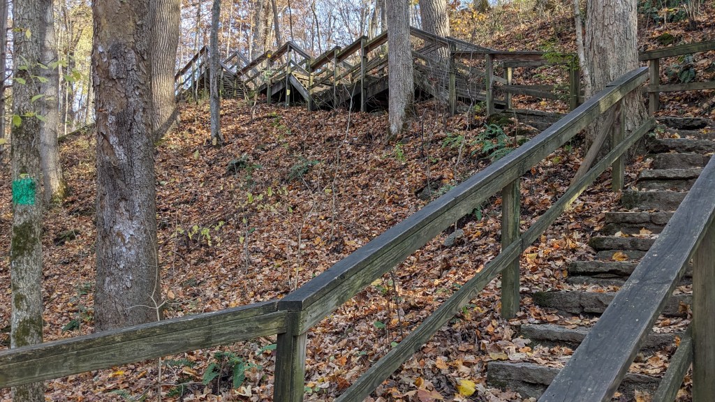
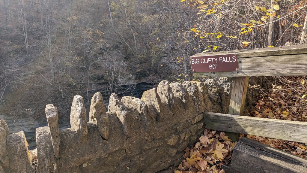
The rest of the hike was a lot of stairs up and down. The trail stays on the side of the canyon all the way back to the north entrance of the park. Trail 5 leads to Trail 6, and Trail 6 to Trail 7. Trail 7 is the northernmost trail on the east side of the canyon and leads to a variety of overlooks to see Big Clifty Falls. Big Clifty Falls is beautiful with layered limestone steps leading down to the final 60 foot drop itself. There is also a Little Clifty Falls, which ironically is the same height, but much narrower. Trail 7 crosses a bridge directly over the top of Little Clifty Falls.
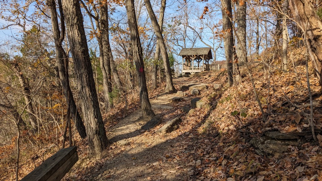
There are a variety of viewing points and even benches for viewing the falls and the canyon beyond them. I can imagine how crowded it must be on a weekend in the summer. Even this random Monday afternoon, I saw a dozen parties hiking all around the canyon just like I was. The many parking areas along the eastern side mean that there are many places to start and finish your hike, and that a variety of lengths are possible as well.

Perhaps because of the number of people I saw, I saw almost no wildlife. I heard birds singing in the trees and even saw a few on nearby branches. However, I saw only one mammal, a chipmunk, on my entire hike. This has been the least amount of wildlife I have seen on any hike so far. Luckily the scenery and the canyons themselves make up for the lack of wildlife. The views are pretty, but most of the trails are steep or have lots of stairs. It is not the most accessible park. However, if you are reasonably in shape, I think you would enjoy hiking the trails. They were well marked and easy to follow.
